Featured

THE ALLIANCE – Navigating the St. Lawrence Seaway, the Welland Canal, and the lower Great Lakes

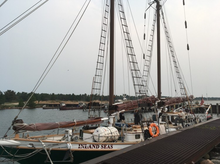
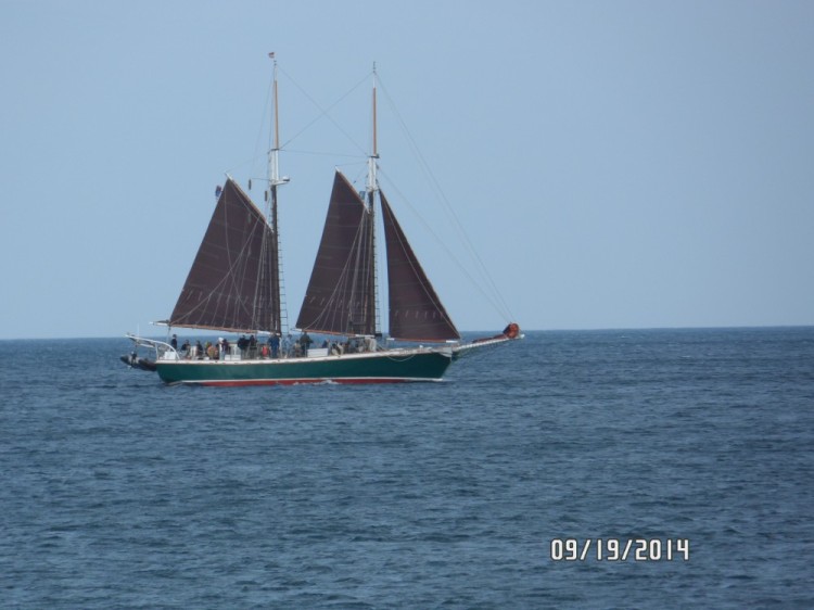
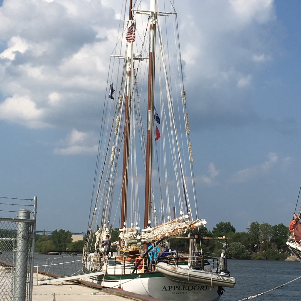
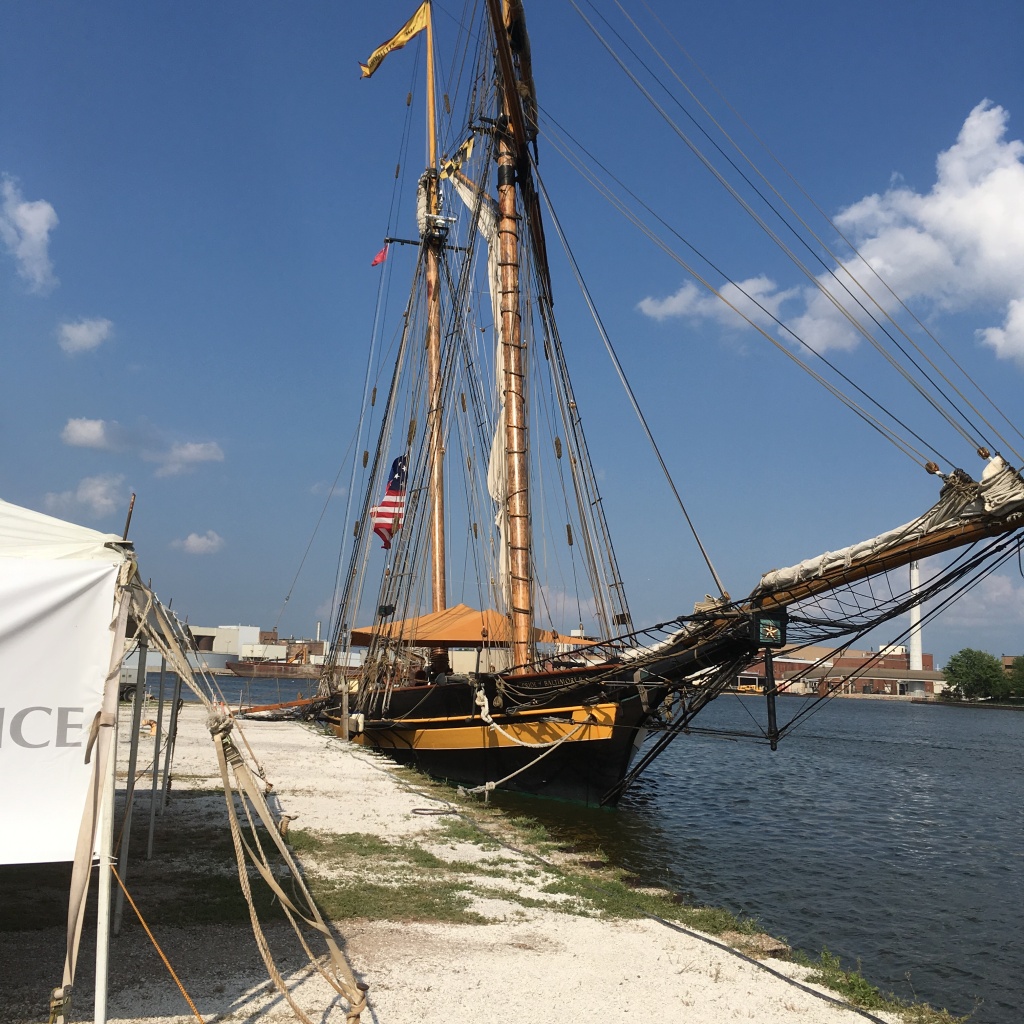
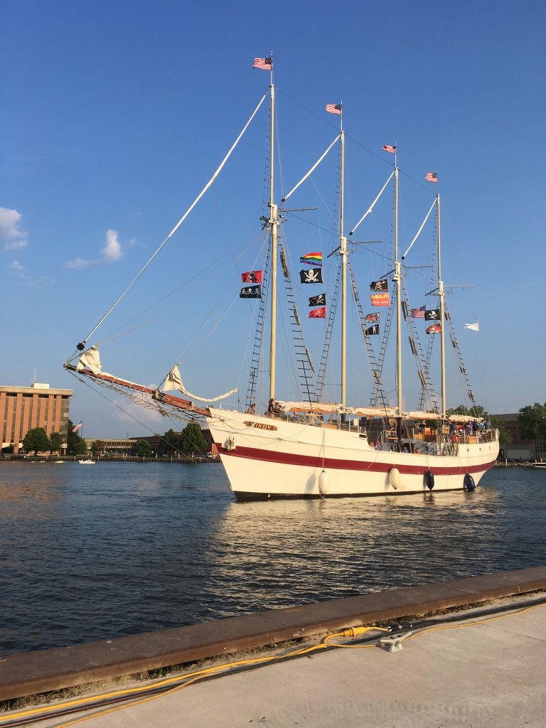
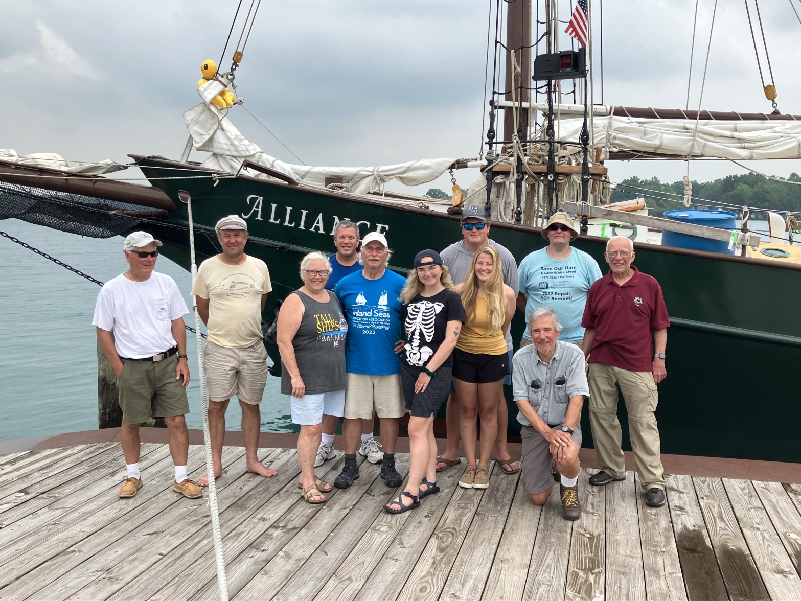
The Alliance is the newest member of The Inland Seas Education Association fleet of schooners. It was purchased to provide more opportunity for schools and families to learn about the Great Lakes. It will take a journey of about 3,000 miles to sail it from Maryland, to its new home in Suttons Bay, Michigan.

On Thursday, June 29, 2023, I’m up at 4:00 am to pack the truck and pick up Rob on the peninsula before heading up to Suttons Bay to meet the rest of the crew at The Thomas M Kelly Biological Station. We will be driving to Montreal, Canada to meet the new Inland Seas Schooner the Alliance. Traveling with me are fellow crew members Earnie, Wayne, Rob and Rachel.

We will be joining Captain Ben, Pete, Karsten, Tom, and Kari for the third leg of the transit of the Alliance that began back in Maryland on the banks of the Chesapeake River. The first leg left on June 17 Traveling from Maryland to Lunenburg. The second leg sailed from Lunenberg to Montreal where we will relieve the crew and continue on the third leg of the journey.

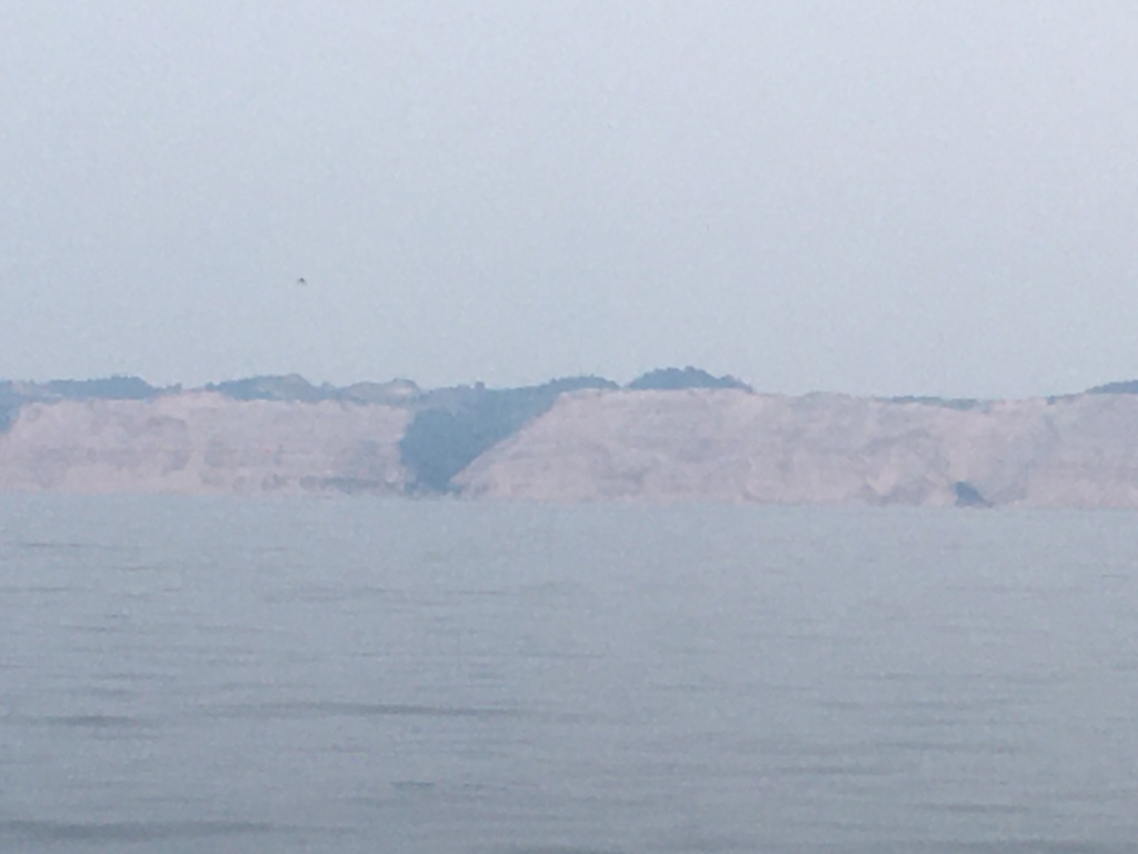
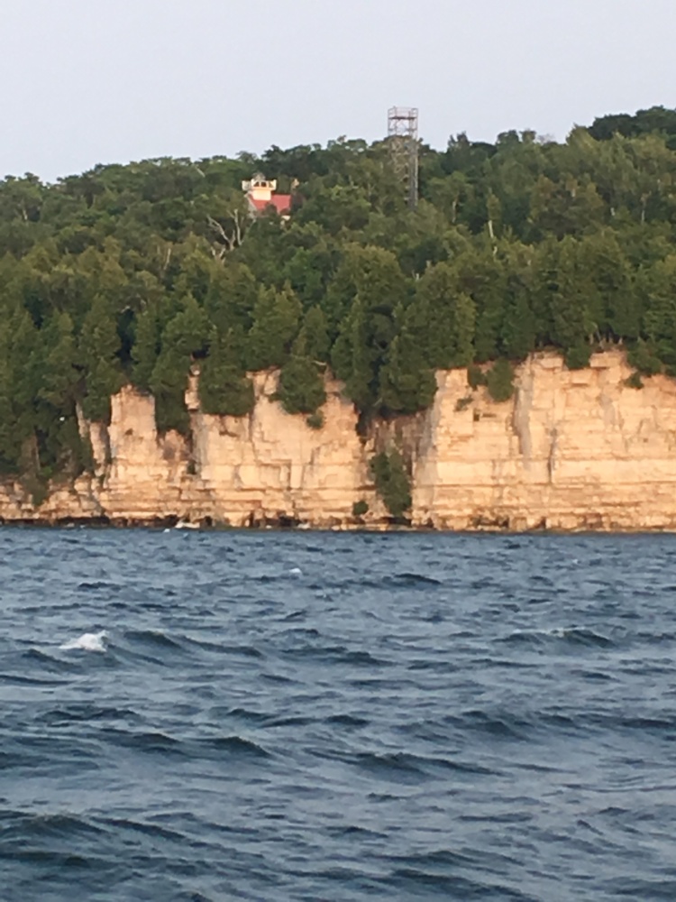
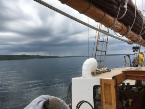
This has been another summer of smoke from wildfires burning up in Canada. Some days when the wind is from the North, it is as thick as fog, and it seems to get thicker now, as we drive South and East into Canada. About 70 Kilometers from Toronto a sign says we are entering the Niagra Escarpment. I can see a change in the geography of the region and know that just south of where we are is the Niagara Falls, just one of the many obstacles we will have to circumvent on our sail back.

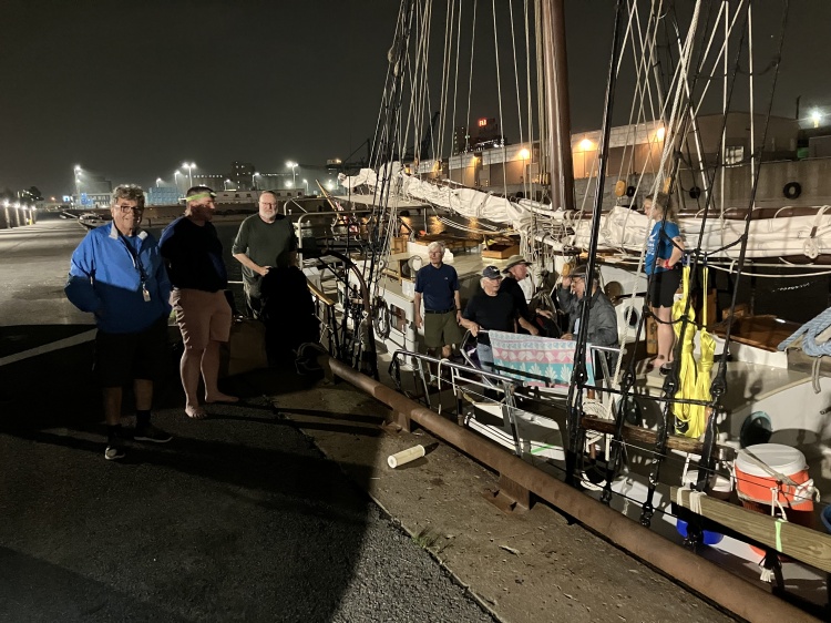
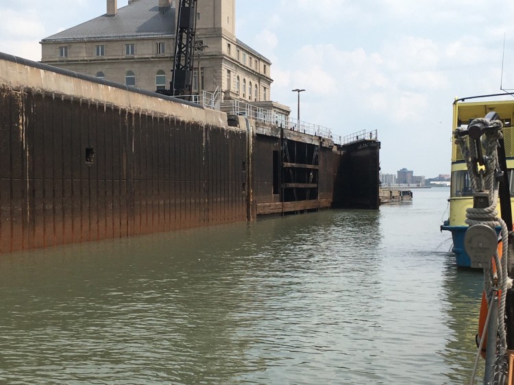
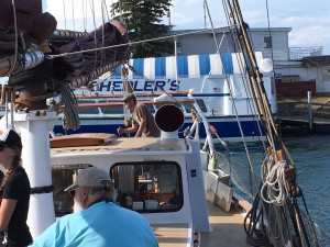
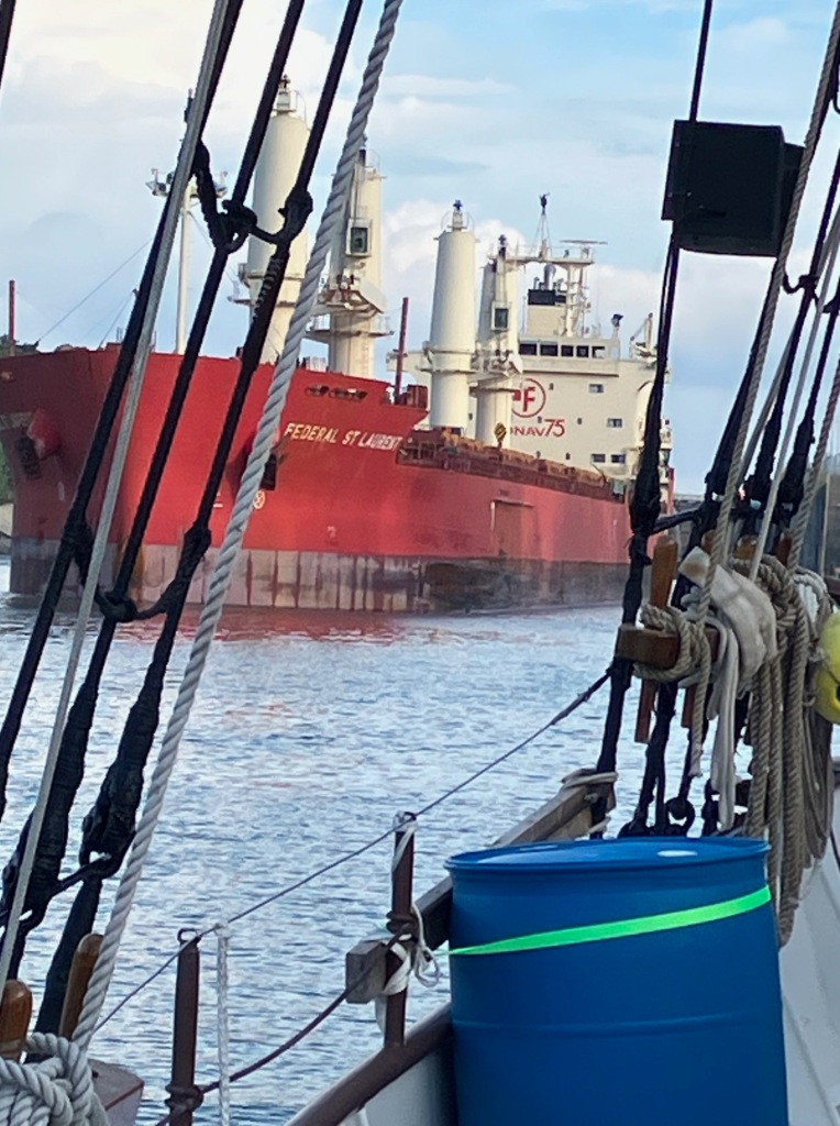
It seems like it takes us forever to get through Toronto while we snack on peanuts, M&M’s and Cashews, thanks to Rachel for providing them for us. We finally arrive at the Port of Montreal after dark about 10:00 PM, and we can see the Alliance through the gate, tied up to the Break wall.

We were given a number to call when we arrive, so the port authority can remotely open the gate for us. Rob calls the number and a man answers speaking French and before he can explain what we needed he hangs up? We try again and Rob try’s speaking broken French and he hangs up again? This time Rachel calls and a woman answers who speaks English and immediately opens the gate for us.

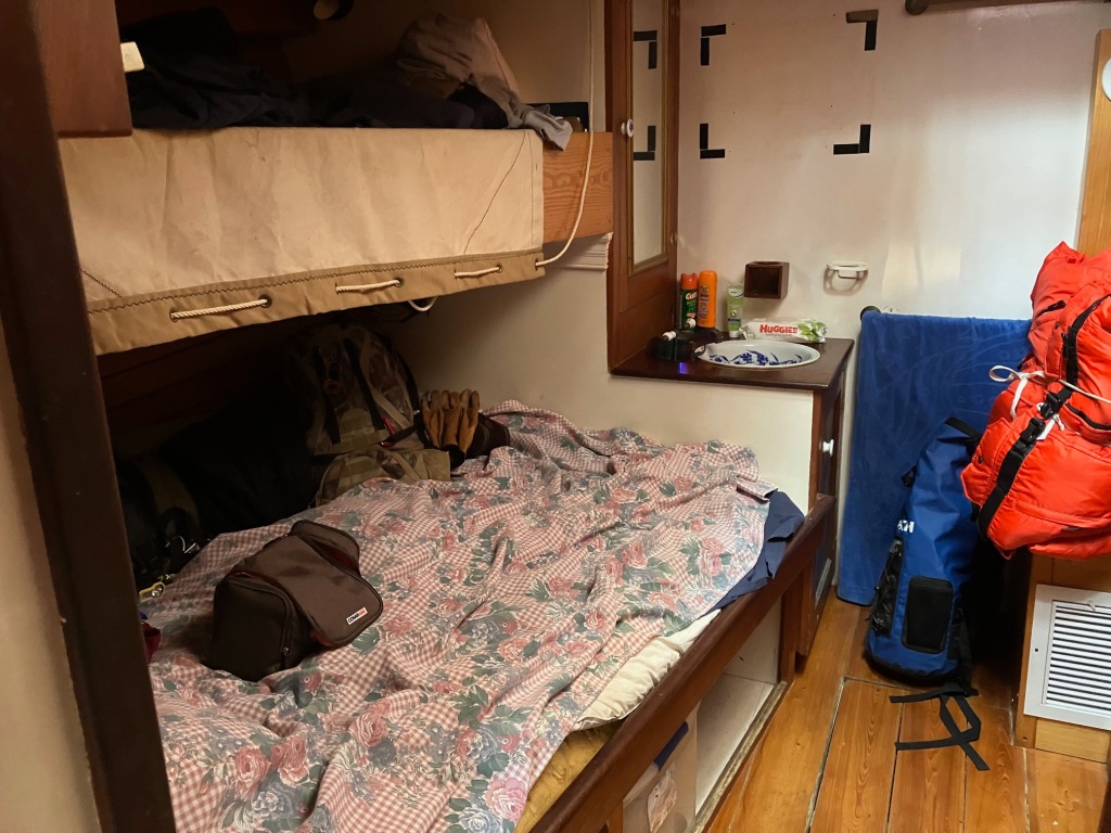
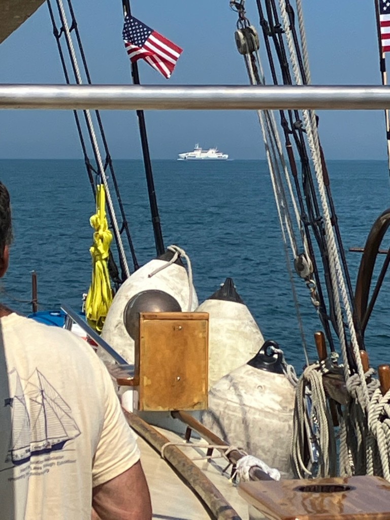
We drive through the gate and park next to the Alliance where the crew we are replacing are moving their gear onto the break wall. We start unloading our gear and after a short welcome we go below and select a cabin and bunk. Rob and I are assigned Cabin one, port side, forward and I take the lower bunk. We unpack and settle in for the night.

We are awakened at about five am by an ocean freighter pulling into the port and using its bow thrusters to dock at the pier next to ours. The name on boat is the CT MA Voyager II that travels between Montreal and Newfoundland. I watch from our deck as they begin to unload their cargo. After this I go to the galley for French toast and sausages prepared by Jeanie, our fabulous cook.

After breakfast we have an inspection by the St. Lawrence Seaway Authority to make sure we are properly equipped to continue through the St. Lawrence Seaway Locks. We also take on a thousand liters of diesel fuel for the trip. The captain plans to leave early tomorrow morning. I help carry off some trash left over from the week before.

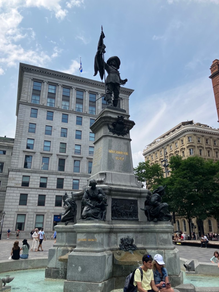
After sandwiches for lunch, we have the rest of the afternoon to explore Montreal, so around Montreal old town, we did roam. Since this was Canada Day weekend there was a carnival atmosphere with a lot of tourists and celebrations in the streets. We stopped at a museum of illusions and as we roamed through old Montreal, we came upon a statue in the city square. I figured this must be a statue of some famous French explorer but Since everything was in French, I couldn’t tell who it was.

It was a hot day so We stopped at an ice cream shop to refresh ourselves. We walked through a carnival and had dinner in an old building that served its signature dish of Poutine and chicken which is actually just French-fries and gravy “eh”. We took a short cut back to the boat crossing over the old locks that used to bypass the rapids and stoped in at a blacksmith shop for a short tour.

It was Jacques Cartier, a French Explorer, who discovered the Gulf of St. Lawrence in 1534. The following year, he sailed up river and found an island and a wild rapids blocking any further travel up river. This is probably why the upper Great Lakes were explored before the lower Great Lakes. He named the island Montreal.

Paul de Chomedey, Sieur de Maisoneuve, traveled to the island from France in 1642 with a group of colonists to colonize Montreal and became the islands first governor. It soon became a hub for the fur trade and exploration of the northern Great Lakes. Further travel north and west however, would have been from the Ottawa River and eventually connecting in Georgian Bay on Lake Huron. The statue, I find out later is for Chomedey.

Saturday, July 1

Attending a meeting using the ships portal

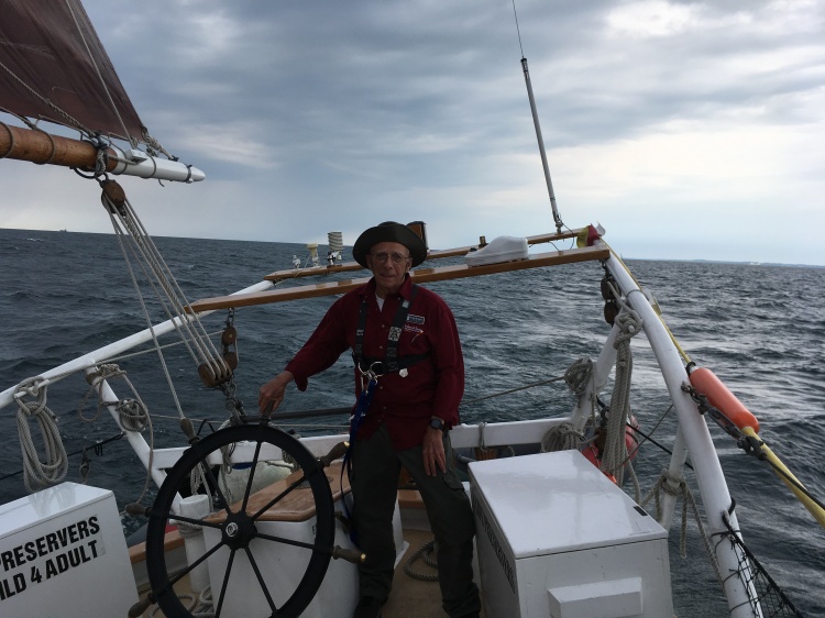
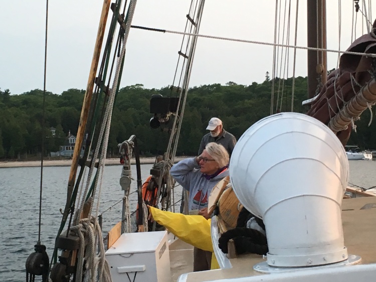
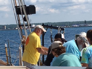
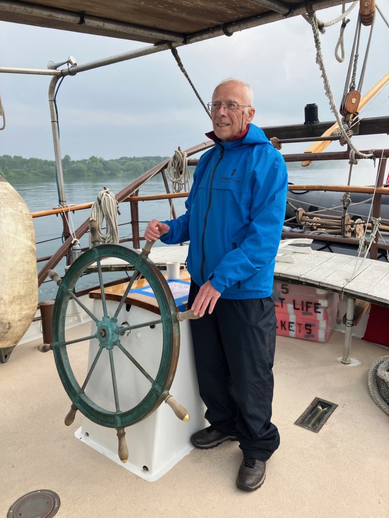
I am up a 6:00 am for breakfast at 7:00. We will be leaving this morning after our travel planning meeting with Captain Ben. Because we are a large craft, we will not have to tie up in the locks but can remain in the center while the locks lift us to the next level. We all review the duty roster with the captain, and I find I am on the 4:00 to 8:00 am and the 4:00 to 8:00 pm shifts. Sun rises and sunsets. What could be better than that. With me on this shift includes Kari, and Pete the assistant Captain. We will also have some galley duties which include cleaning the galley surfaces. Kari, one of our mates, brings a fresh set of “Alliance” pennants for the crew to sign. They will be flown above the boat on our leg of the trip.

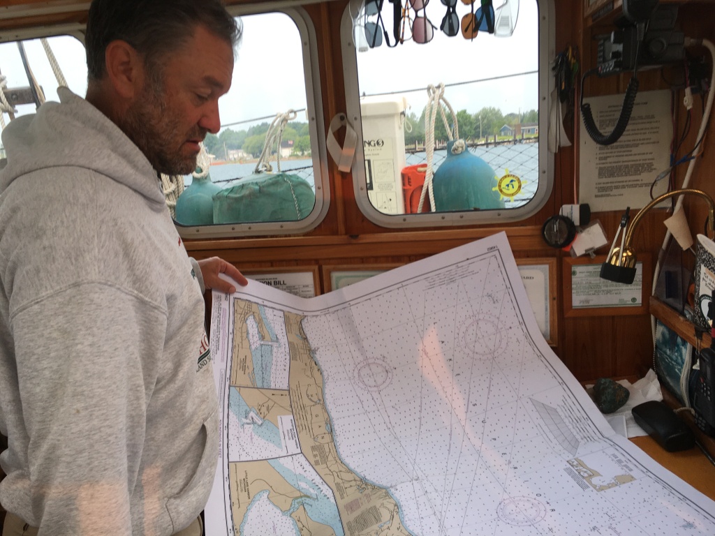
Meals will be at 8:00, 11:30 am, and 3:45 pm. We will use jacklines at night except when we are in the locks where it will be “all hands on deck”. After the meeting we make the boat presentable for the trip. The captain reviews the charts and all the check points along the way for the 7 locks we will have to navigate between here and Lake Ontario.

As we were waiting for the call from the lock master, we did a couple of drills. First a man overboard drill and then a fire drill while still secured to the pier. Finally, around 3:30 pm, we get the clearance to begin our journey up the St. Lawrence. We Cast off the lines, coil them, and move away from the pier.

As we approach the entrance to the St. Lawrence River, I can’t help but notice how turbulent the water is flowing by the harbor entrance. But, this isn’t just any water flowing by here. It is the water from all five of our great lakes. It is a virtual “alphabet soup”, representing thousands of micro habitats that make up the great lakes and connecting waters, all racing to the Atlantic to tell their stories to the sea.

The captain pushes the bow out into the turbulent river and turns downstream, the only direction we can go because of the Lachine rapids just up stream. We travel down and across the current behind St. Helen’s Island to the entrance of the St. Lawrence Seaway and the calm waters of the canal. The St. Lawrence Seaway opened in 1959 and for the first time, ships from around the world could now enter our Great Lakes and sail as far inland as Duluth Minnesota.

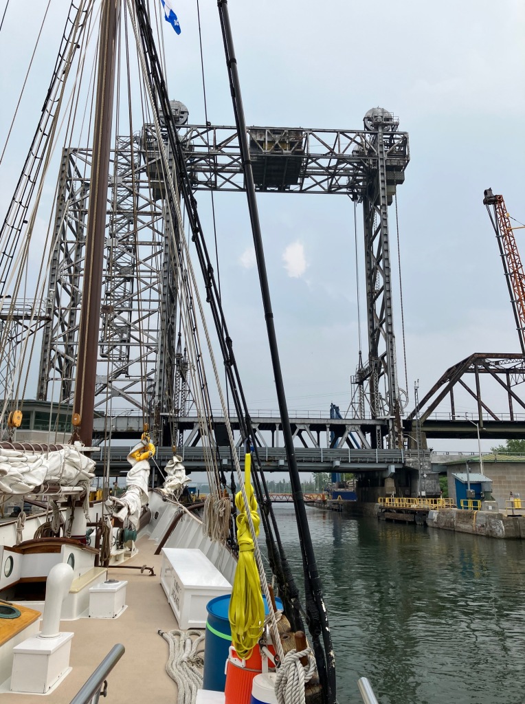
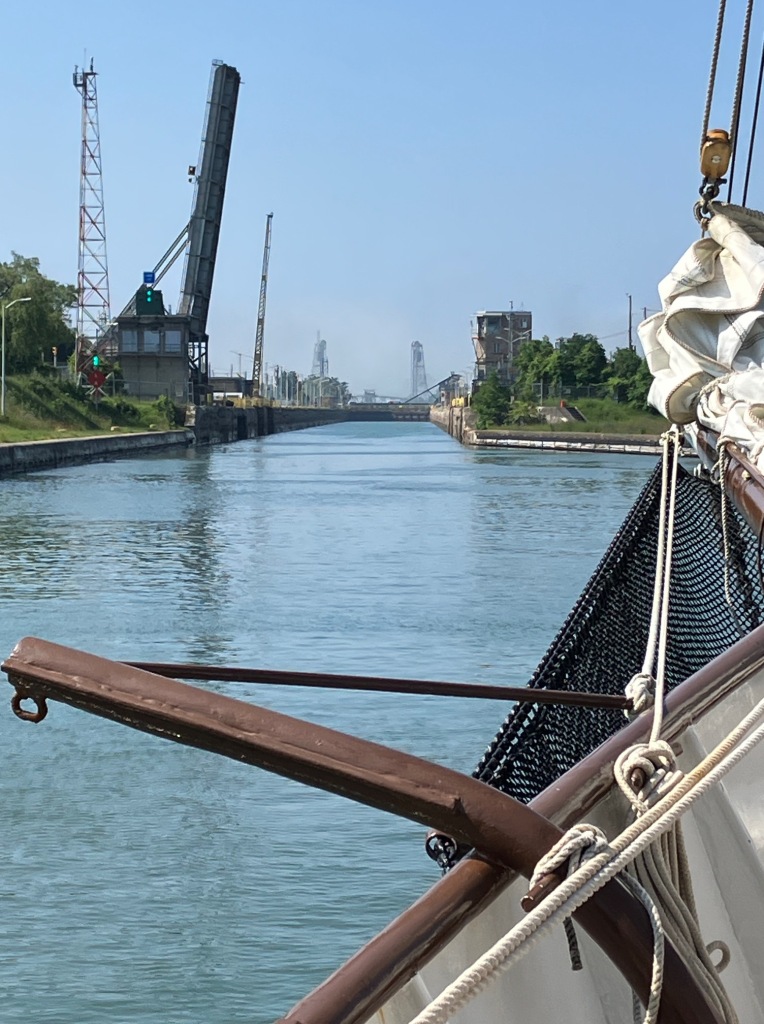
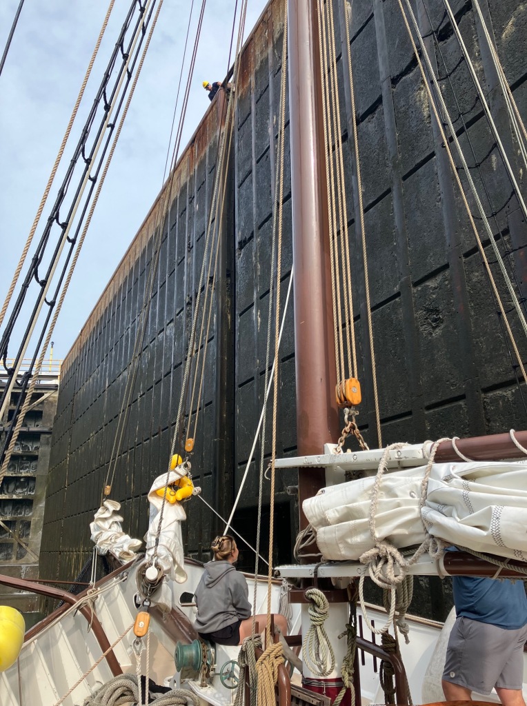
Not very far ahead is the St Lamberts Lock. Our first lock and it is all hands on deck. This lock, and all the rest on the St. Lawrence, is 14 meters high. That’s about 45 feet high and over twice the height of the locks at Sault Ste Marie. It was a little stressful trying to keep the boat in the center of the lock.

The water came into the lock from below the boat and the turbulence moved us towards one wall and then the opposite wall. We had to keep moving the bumpers from one side of the boat to the other while the captain, skillfully using forward and reverse engines, tried to keep us centered in the lock.

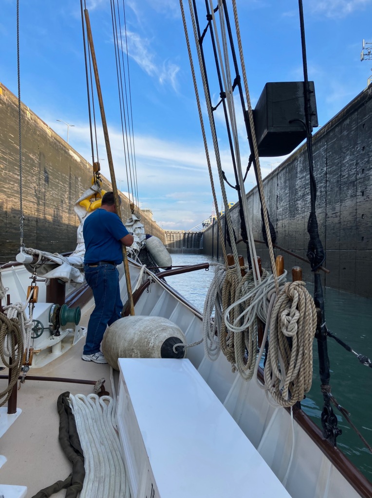
Rob uses a long pole to push against the lock wall to keep the bow sprit from making contact. In retrospect, I think it may have been easier just to tie up to one side of the lock, but we made it through without any part of the boat touching the wall and now more prepared for the next lock.

An interesting fact, the locks on the St Lawrence Seaway are only 766 Feet long and 80 Feet wide. Sault Ste Marie Michigan has a 1,000 foot lock and they are in the process of building a second one the same length. These locks are for the big lake boats and not the Ocean freighters.

The canal and lock system parallels the river here and the Cote Ste Cath Lock is not too far ahead. The banks of the canal are covered in vegetation and trees except next to the locks where it’s concrete with places to tie up. It looks like we are just motoring up a lazy river.

It’s raining now and continues to rain the rest of the night. We make it through the second lock, the Cote Ste Cath Lock, much easier this time and continue on as the canal connects us back to the river. The river widens out into Lake Saint-Louis here and we now follow the red and green bouys to stay in the shipping channel across the center of the lake.

At the end of this lake we come to the Beauharnois locks. There are two locks close together here that take us over the Beauharnois power dam and into the Beauharnois Canal. This canal takes us around the Pointe-des-cades Rapids. When we arrive, however, the lock has an electrical problem with a boat in the lock so we have to tie up for awhile and now it’s getting dark.

It was well after dark by the time the lock was fixed and the freighter moved out and downstream. We moved into the lock and passed through this lock and the next lock without too much difficulty as it continued raining through the night.

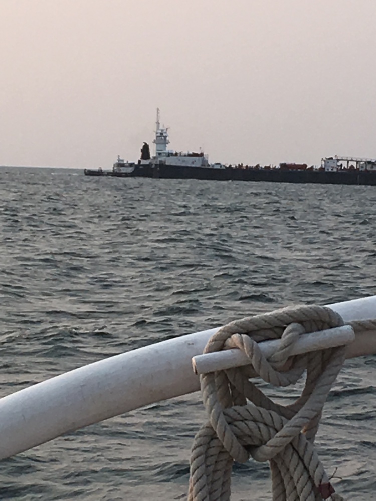
Sunday morning, we went through two more locks on the American side of the river that were separated by the Wiley Dondero Canal. We were then brought back out into the river. Later we were passed from behind by an ocean freighter from Algoma Central.

The next and final lock on the St. Lawrence Seaway, is the Iroquois lock which is much lower than the other locks on the seaway. This lock takes us around the Iroquois control dam that is essential in controlling the water levels in the river. It’s height depends on the height of the river which changes with spring rains and summer droughts that change the flow. Today, it appears to be the same height on both sides of the lock so they open the doors and we pass through without stopping.

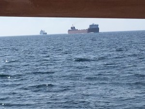
We are now back out into the river and spend the rest of the day watching the scenery as we follow the buoys to stay in the shipping channel. I am surprised that we only meet a few ocean freighters as we motor up stream. The traffic seems very light.

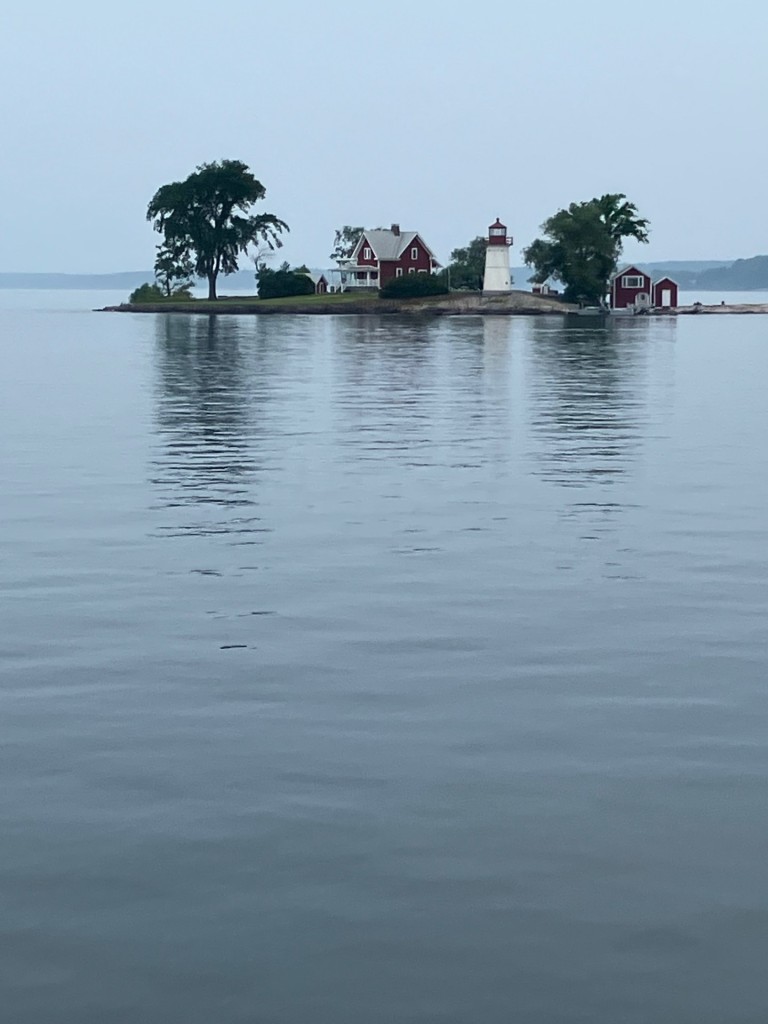
We travel through a picturesque part of the river lined with beautiful homes and After dinner we enter the Thousand Islands area of the river. Here, the river widens and is filled with islands of all sizes. Some as small as huge rocks, others just big enough for a house and boat dock and still others with many homes and small harbors. There are even a few islands with castles. We all stand on deck and watch this panorama go by as the sun goes down.

Monday morning, as I awake at 3:30 am for my 4:00 am watch, I notice a difference in the sound of the engine. It is now running at full speed and there is also a change in the air. It is a little cooler and fresher and this could mean we are out of the St. Lawrence River and are now on Lake Ontario.

As I leave my forward cabin to climb the ladder and emerge on deck, my feelings are confirmed. We entered into Lake Ontario sometime in the middle of the night. Pete said there was some turbulence at the entry to the lake. It’s as if the river did not want to give us up and was trying to hold us back.

Today as I take the helm, I am now steering by a glowing compass in the dark with a heading of 250 degrees West Southwest. We no longer have any landmarks or buoys to steer by, only open water in all directions. It will take us most of the day to reach the Welland Canal at the other end of Lake Ontario.

Lake Ontario is the Eastern most Great Lake and the smallest in surface area of 7,340 square miles. However it exceeds Lake Erie in volume because of its great depth of 802 feet. Interestingly, early geographers considered all of the Great Lakes to be part of the St Lawrence River. They decided that the river actually started up in Minnesota with the St Louis River that flows into Lake Superior. That water then spills from Great Lake to Great Lake until it flows out of Lake Ontario and into the St. Lawrence. Of course this was a great simplification.

Lake Ontario is different from the other 4 Great Lakes in that it has always been connected to the Atlantic Ocean. Since the ice retreated from the last ice age about 10,000 years ago, Lake Ontario has been home to many anadromous fish species, both desirable and undesirable. Species like Atlantic Salmon and Lake Trout, and species such as the Sea Lamprey and Alewives. The upper 4 Great Lakes were isolated from Lake Ontario and the Atlantic by the Niagara Escarpment until this was breached by the Welland Canal in 1829, allowing the Sea Lampreys and Alewives, that were already accustomed to living in fresh water, entrance to the rest of the Great Lakes.

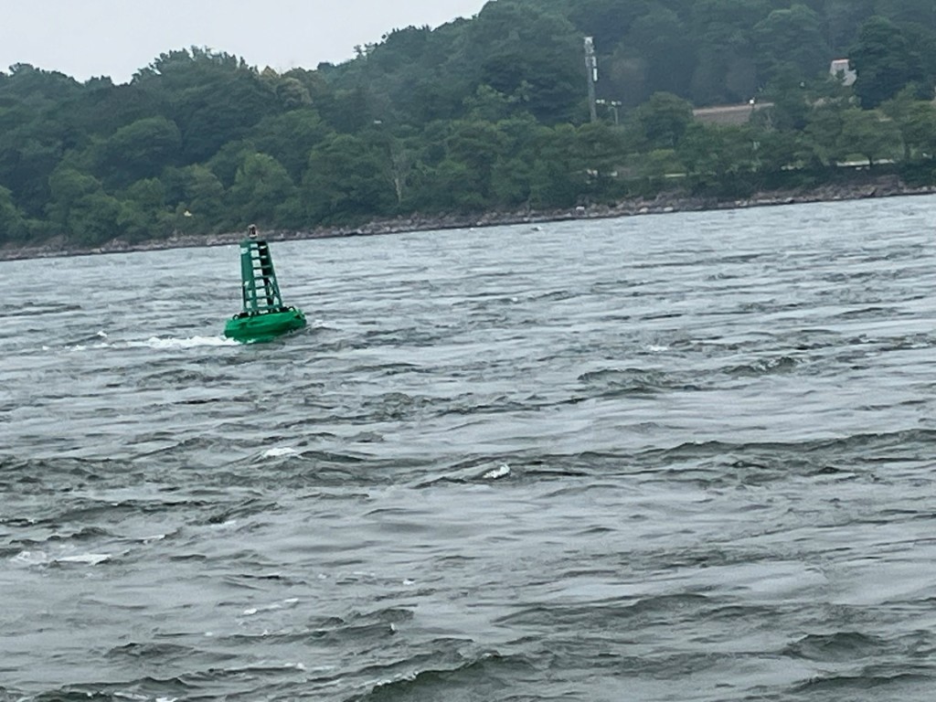
There is not much to see except water when your out in the middle of such a large lake. You have no site of land or any landmarks. So having a freighter pass us from behind becomes an event. On bow watch, I see what looks like a marker bouy in the distance which is not on the charts. As we came closer, we discovered it was just a big red Mylar balloon. We try to catch it but missed. Unfortunately, more micro plastics in the lake.

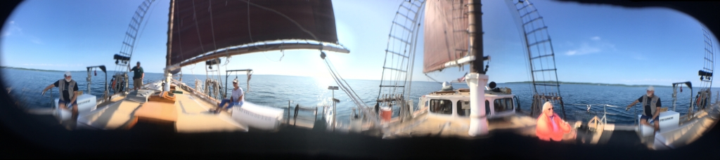
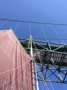
Traveling on the big lake gives me time to become familiar with the Alliance. The boat is much larger than the Inland Seas and has more deck space. The deck is on two levels with about a foot drop down from the stern to midships. Something I had to get used to in the dark. It also has two fire hoses with a pump that is run off a Generator.

Since the Alliance has three masts, there are more pin rails on the outside and on the inside of the deck and I spend some time examining the lines to learn what each line is for. I also learned that the first mast is not the main mast but is the Mizenmast. The Mainmast is in the middle followed by the Foremast.

The Welland Canal in Ontario,Canada, consists of 8 locks and traverses the Niagara Escarpment between Port Waller on Lake Ontario, and Port Colborne on Lake Erie. The total length is 27 miles and will raise our boat about 167 feet to bypass Niagara Falls. These locks, like the ones on the St. Lawrence Seaway, are also very high – 14 meters which is around 45 feet.

We enter the first lock on the Welland Canal with experience now and the lock crew drops us lines to keep our starboard side against the wall of the lock. The rest of the locks will line up in good order and we should be through them in a few hours.

After the second lock, my shift ends and I am relieved of duty since we no longer need all hands on deck. I figure by the time my shift begins tomorrow, we should be cruising across Lake Erie. Back in my bunk I hear us go through one more lock and I fall asleep.

When I awake Tuesday morning at 3:30 for my first shift I am surprised that I don’t hear a sound. I hear nothing from the engine room and nothing from the crew. Just silence. I also can’t feel any motion and wonder what has happened. I quickly dress and climb the ladder to topside, and emerge on deck to find no crew on duty.

I look around and can’t see anything past the bow of the boat and discover we are tied up to shore just below one of the locks. The fog is so thick they must have closed the locks sometime during the night. I walk to the starboard side and see a sign that says we are tied up somewhere on the canal below lock 8, the last lock on the canal.

I ascend the steps into the galley and make coffee. A little while later Rob comes in with the same questioning look, so we sit and talk over coffee. Evidently, according to the captain, the fog started rolling in during the transit of the locks last night and after the seventh lock the lock master shut everything down until visibility improves.

Finally, around 10:00 am, we are called on the radio by the lock master saying the fog has thinned enough for us to proceed to lock 8. I grab a life vest and hop off the boat to remove the dock lines and climb back aboard and begin steering up the canal. We pass a tugboat pushing a barge downstream and several private boats as I keep to the side of the canal to give them plenty of room.

As we near the lock, we have to pull over and wait while a down-bound freighter pulls out of the lock. I steer in behind it to line up with the lock and get in his wake and prop wash and in the current of a side channel and I find I can no longer control the boat. I notify the captain and he takes over and gently guides the boat into the lock.

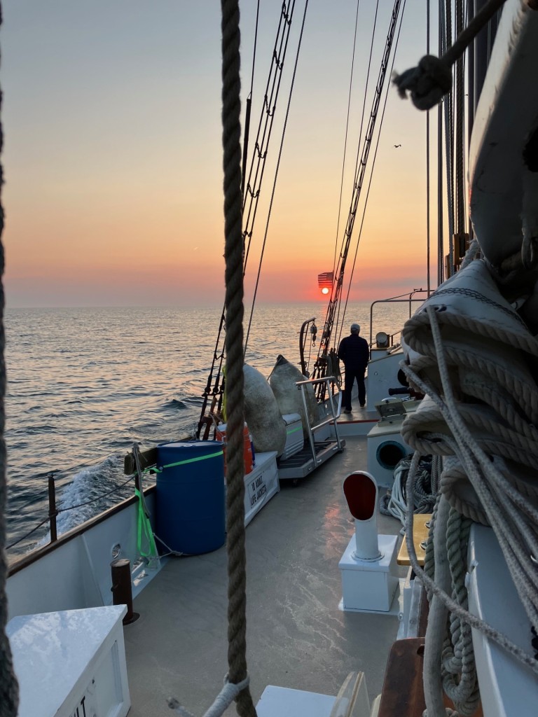
Lock 8 is not very high. It’s only about 1 meter difference here between The canal and Lake Erie. As we travel through the lock and motor up the canal to Lake Erie, I can see where the canal ends at the lake, but nothing further. We motor out into the lake and disappear into a heavy fog. The Captain connects the fog horn which now sounds about every three minutes as we plot our course to WSW 250 degrees at about 6.5 knots. I listen intently for a return fog horn from other boats but none are heard.

As we continue our journey across the lake the fog slowly lifts. We have sandwiches for lunch as we pass long point, the only site of land we see all day. Long Point is a point of land that stretches down from Canada almost to the middle of Lake Erie to catch seamen unaware in the fog. There are many shipwrecks along its point that show how successful it was before better charts, radar and gps were invented.

Before dinner, our cook Geanie cooked herself a birthday cake and we all celebrated her birthday. After this I go back to my cabin for a bath. It has been a long and hot day out on the lake without much wind and it is very hard to find any shade on the boat, so you are exposed to the sun all day. My bath consists of 5 Purell Hand Sanitizing body wipes and a wet washcloth to rinse. I brush my teeth and go to bed.

Wednesday morning I awake about 3 am fully refreshed and report for duty at 4:00am. I went to bed at 9:00 pm so I had a good 6 hours of sleep and that is a lot of sleep on a boat. During my 4 hour shift I rotate from steering, to boat checks – which includes checking all the bilges for water, recording refer temperatures, all the engine, and generator readings in the log book, and bow watch.

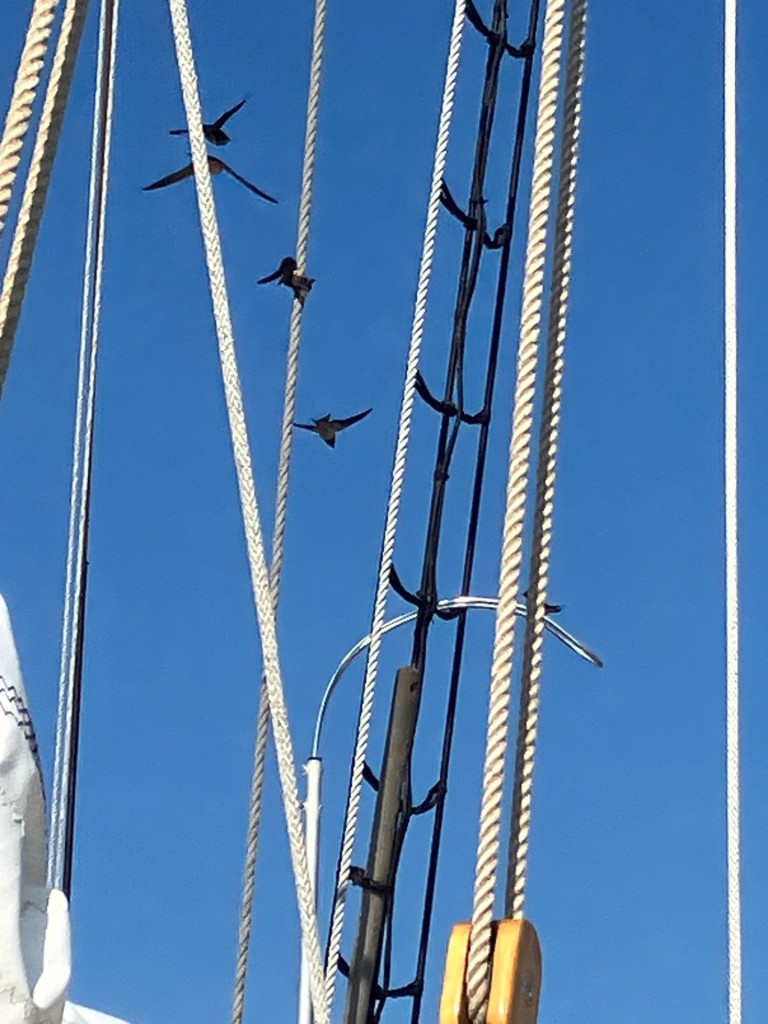
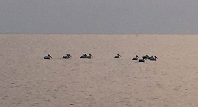
Bow watch, when crossing one of the Great Lakes, can be kind of monotonous. There is not much boat traffic out here and you have no site of land. I did happen to see four White Pelicans though. Three flying and one in the water. This is only the second time I’ve seen them on the Great Lakes. We also had some unexpected visitors today. A flock of birds, like swifts, that I assume were chasing bugs as they were flying in and out of our rigging. They stopped to rest and travel along with us for a while but were soon bored and moved on.

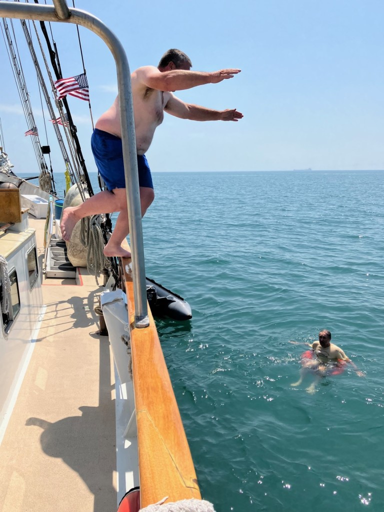
We continued crossing Lake Erie when the Captain called a man overboard drill to keep us “on our toes”. After the drill, we leave the rescue boat in the water and bring it around and tie it up along the starboard side. We then all go swimming to cool off in the middle of Lake Erie. It was refreshing while in the water but didn’t last long when we got out to continue our journey.

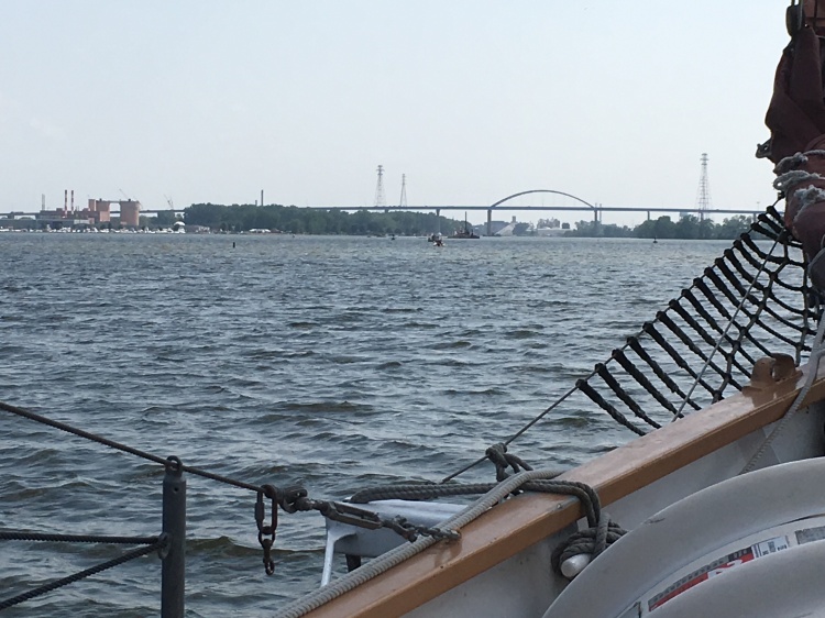
As we get closer to the other end of the lake, we slow down between Point Pelee and Pelee Island as the Pelee Island Ferry passes in front of us. The first thing that comes into view at the end of the lake is the Monroe Nuclear Power Plant and soon the marker bouys to line us up to enter the Detroit River.

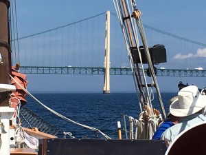
As we get closer to the entrance to the river we begin to see these huge rafts of green lake weeds floating by. We follow the marked channel up the Detroit River and pass under the partly finished Gordy Howe Bridge followed closely by the Ambassador Bridge, And we now have a lot of traffic with freighters and small boats going in all directions in front of us.

The Detroit River has several live web cams and Rob tries to log into one so we can see ourselves pass by. One of the live web cameras is streaming from the historic Bell Isle Dossin Museum (http://www.webcamtaxi.com).

As I’m steering the captain tells me to keep traveling as straight as possible upriver as the M.S. Westcott mail boat pulls up alongside and matches our speed. He hands off some mail to the captain and continues on his route delivering mail to the freighters on the river. It has its own zip code 48222 and provides mail service for the US Postal Service to vessels traveling on the Detroit River. Interestingly, when the Westcott Co. was established in 1874, John Westcott was delivering mail using a rowboat.

After a short while we enter Lake St Clair which is a shallow lake, so we have to follow the marker buoys to stay in the shipping channel. There is a small sailboat race that is using one of the channel markers for their turning point as we pass by. We reach the St. Clair River after dark and finally tie up about midnight in Algonac, Michigan, our final destination.

This was a wonderful, once in a lifetime trip that I enjoyed immensely. The following morning we toured the maritime museum before beginning our trip back to Suttons Bay after being relieved by the next crew change for the final leg of the trip.

At the time this was published, Tall Ships America, a national sail training organization, recently honored our own Captain Ben as “Sail Trainer of the year” for 2023. An honor well deserved.

Alliance Crew: Pete, Captain Ben, Jeanie our cook, Rob, Earnie, Rachael, Karsten, Kari, Tom, Wayne, and Frank

The St. Lawrence Seaway of North America, by Anne Terry White
A 1,000-Mile Great Lakes Island Adventure, by Loreen Niewenhuis

Featured

Lake Superior Down-bound – Sailing The Inland Seas

Red sun rising over the Inland Seas in Marquette’s Ellwood A Mattson Lower Harbor Park, Lake Superior

Monday August 2, 2021

I’m sitting on deck of the 77 foot schooner “The Inland Seas” in Marquette Harbor on beautiful Lake Superior, enjoying a cup of coffee on a hot Monday evening after a travel day from Suttons Bay, Michigan. Early this morning I met Bob Hagerman and his wife at the Thomas M. Kelley Biological Station in Suttons Bay to catch a ride north to Marquette in Michigans upper peninsula. Bob and his wife will be taking a vacation in the U. P. and said they will meet us in Sault Ste. Marie to take pictures of the schooner as we go through the locks.

Bob has volunteered with the Inland Seas Education Association for a long time. He told me he has served in every position on the boat. I first met Bob when he was First Mate and I was an instructor and crew in training while sailing on Suttons bay with Captain Tom Kelley. I also sailed with him on trips up to Escanaba with Captain Ben Hale. Bob is always a lot of fun to sail with.

When we finally arrived at the boat I quickly went below, choose an open bunk and stowed my gear for the trip down Lake Superior. We will be sailing from Marquette through the Soo Locks to a mooring on the St. Marys River, about a 3 day trip, where the staff will provide a few days of programming on the river. I met with James and Rob, other members of the crew, and we walked into town to find a place for dinner. After dinner I stopped for an ice cream and returned to the boat.

As I’m sitting on deck I notice a young family, father, mother with a small baby in her arms, and a small boy, slowly walking along the break wall towards us. They look at the Schooner Inland Seas as they walk by but the boy stops and doesn’t move. He’s looking at the boat and his mother is trying to move on but the young man won’t budge. I walk over to the railing to talk to them and try to start up a conversation with the young man but he is very shy.

Fish Traps used aboard the Inland Seas

The father then starts to talk to me about the boat and I start telling them what we do and about our mission and I notice the mother and father getting very interested when they discover we are different than other tall ship schooners. We are also, and more importantly, a science ship and a school-ship. They start asking a lot of questions and we end up talking together for about a half hour. I find this is a common occurrence while talking to families in away ports.

Data Sheets used to record samples

It can sometimes be difficult to attract kids to science these days without something to grab their attention first and then keep it with all the electronic distractions that so easily kidnap their young minds. A lot of children today live in cities and don’t have access to nature at a young age. Some have never even seen the Great Lakes before. A schooner is a good way to attract attention and bring them on board. But that in itself is not enough. They also need to immerse themselves in nature.

Richard Loud, in his book “Last Child in the Woods” talks about this. He points out that many children today don’t even have the opportunity to play in nature and are suffering from what he calls a “nature deficit disorder.” It’s important that we realize that these same children will be making the decisions about the Great Lakes in the not-too-distant future.

I have seen the change in children and the excitement when they are directly involved in the sampling and the touching, hearing, seeing and smelling of the samples as they dig into the benthos with their hands; Or trying to catch a flopping fish when they try to put them on the measuring board; or watch plankton under a microscope as those tiny transparent critters dash across the screen in front of them.

Thill & Sons Fish House on Marquette’s Lower Harbor
Jeanie our cook ordering Whitefish for our trip at Thill & Sons Fish House on Marquette’s Lower Harbor

Science is ingrained in the culture aboard the Inland Seas. The captain and crew, the staff and the volunteer instructors all take it very seriously. Though we always try to adjust the message to the age group involved, and we all may have a different way of doing this, we are very careful to follow the guidelines so that all of our data is collected and reported in the same way every time. For this we use detailed data sheets that have been designed to provide useful data that can be uploaded to share with other organizations and that we can use to show changes and trends that we have discovered in the Great Lakes over the years, and there are many.

The following morning, we awake to a deep red sun in a hazy sky caused by the smoke in the atmosphere from the fires burning up in Canada. I’m up early and sitting on deck with a cup of coffee thanks to Jeanie our cook who gets up and makes coffee for us early risers. Jeanie is a really great cook and also takes care of our first aid needs by quickly patching us up and sending us back to work. I’m taking a few pictures of the sunrise when Jeanie says she is off to see the “fish monger”. Not knowing exactly what she means, I just have to tag along. Juliana and I walk with her over to Thill & Sons Fish market in the harbor where Jeanie selects some fresh Whitefish for tonight’s supper and then we return to the boat to prepare for departure.

We have a short meeting with the captain and are divided into two work groups. Finally, Captain Ben starts up our Diesel engine as we prepare to cast off. First Mate Rebecca jumps ashore and we bring on board the boarding platform and secure it at the bow. Before climbing back aboard, Rebecca removes our lines from the cleats on the break wall and we coil and store them on board.

We motor out of the harbor, past the break wall around 10:30 AM and set our course to ENE at 070 degrees into a very calm Lake Superior. The water has a slight undulating gray appearance reflecting the Smokey sky with a very light wind. As we set an easterly course, I look out across Lake Superior and feel that something is wrong. This is not the Lake Superior I remember, and I wonder what is going on with the environment this year.

We put up all of our sails to try and catch as much wind as possible: Main, Fore, Staysail, Jib, Jib Top and Main Top sail but the wind is so light we have to keep the diesel engaged and continue motor sailing. After the sails are up, I take the first shift at the helm. We are traveling a couple of miles or more offshore and the lake is calm out here and the air is very warm which is uncharacteristic for Lake Superior.

As I monitor the surface water temperature readings I am surprised to see it averaging between 69 and 70 degrees. I have always known Lake Superior as being very cold water. I remember camping, canoeing and fishing our way around Lake Superior with my family back in the early Sixties. It was a hot summer and I remember running to the beach to go swimming and finding the sand so hot it was burning my feet. I’d run into the water and it was so cold it would make my legs ache. Today, the air and water are both warm and we are plagued by black flies way out here on the lake.

Geanie prepares lunch for us of Soup and Grilled Cheese sandwiches. After lunch I help Jeanie in the galley with dishes, one of the many duties we share on board. We will now begin our 6 hours on and 6 hours off work shifts. My shift will begin at 8:00 Pm. and run till 2:00 AM if were still sailing.

We will be passing some of the prettiest shoreline on the Great Lakes including the Pictured Rocks National Lakeshore which extends for 42 miles along the shore of Lake Superior between Munising and Grand Marias. It includes picturesque views of sandstone cliffs and rock formations, waterfalls and sand dunes. It gets its name from the 13 miles of colorful sandstone cliffs reaching up to 200 feet above Lake Superior and was designated the first national lakeshore in the United States in 1966.

Rachel, Volunteer Coordinator at the Wheel with Juliana, Associate Director, Inland Seas Education Association in the background

I am sitting on one of the life jacket boxes on the port side watching the scenery, hoping to get some good photo’s but from this distance, and with the Smokey air, it will be difficult to see much detail and I will have to look at the chart plotter to see exactly where we are. I tease Rachel that according to the chart plotter she is heading towards a reef to make her smile. Of course, its many miles away and she just laughs so I take her picture.

We pass Grand Island, and I can see the Grand Island north shore light as I scan the horizon with binoculars. The island forms the west part of the bay in Munising and provides the natural harbor with protection from the gales out of the northwest. The shoreline running east of Munising is the Pictured Rocks National Lakeshore but unfortunately from this distance I really can’t see much. Jeanie brings around water with cups for everyone to keep us all hydrated.

The Next area I can identify is the Grand Sable Dunes, rising some 300 feet above the lake, they are one of the best examples of perched dunes in the world. Perched dunes are dunes that lie on top of an existing high bluff. At the eastern end of the dunes sits Grand Marias, our next stop for the night.

As we get closer to our anchorage we drop and stow the sails and just before sunset we round a point and enter the small harbor at Grand Marias. We drop the starboard anchor with 150 feet of chain and make the boat ready for the night. I look around the small natural deep harbor and barely recognize Grand Marias. It looks so different from this perspective. I notice a small sailboat also anchored in the harbor and wonder if they are also traveling down bound to the Soo. We have another meeting and lucky for me I don’t have anchor watch tonight. It is still hot, so our First Mate Rebecca and a couple of the crew jump off the boat for a quick cool down. I settle in my bunk for the night to write in my journal and get some sleep.

I’m up at 5:30 am and go up on deck where another smokey red sun greets us for the day. We have Ham and Egg Muffins for breakfast and a meeting with Captain Ben to discuss the days sail. He said since we have a fair wind this morning, and it is from a favorable direction, we will sail off the anchor. This means we won’t be using the motor but will be putting up the sails and sailing out of the harbor like they had to do a hundred years ago. Jillian, who’s curiosity is always looking for a new place to sample, told Captain Ben she would like to take a microplastic sample while under way in Lake Superior since we haven’t taken one here yet.

After our meeting our first mate Rebecca has everyone form two lines, one port side and one starboard side, to take turns at the windless. We take turns two at a time ratcheting in the anchor chain (actually what we are doing is ratcheting the boat up to the anchor). The depth is about 35 feet here in the harbor and we have about 150 feet of anchor chain in the water. This is a good ratio, about 5:1, to allows the anchor to lay flat on the bottom allowing the blades of the anchor to dig in and hold us fast. The extra chain also acts like a large spring, allowing the boat to ride up and down with the waves without pulling the anchor off the bottom.

We continue bringing in the chain until we are now directly above the anchor. We then go to our stations and raise the sails. Immediately after raising the sails, we return to our lines and rachet in the rest of the anchor chain and secure the anchor as captain Ben sails us out of the small harbor. What a site this must have been from the shore. Everyone knew exactly what to do and it was a thrill how everything just came together like clockwork.

We set our course again to ENE at 070 degrees and are making about 4.5 knots under sail. Early afternoon and the wind starts to die again and we are only making about 3 knots so the captain suggested we get our microplastic sample now since this is just the right speed for a good sample. We all gather on the starboard side and launch the Manta trawl somewhere between Grand Marias and White Fish Point. We trawl for 30 minutes and then bring it back on board. Rachael, Amanda, and Jillian then spend the next hour processing the sample.

I have always considered Lake Superior to be my refuge of unspoiled wilderness and never thought that it could be polluted with plastics. The sample we took by the Manta-trawl consisted of a swath of Lake Superior’s surface about a foot wide and about a mile and a half long. Which means we literally just scratched the surface. Amanda takes the sample below deck to take some pictures using a small handheld digital microscope I have been experimenting with. And yes, unfortunately, even Lake Superior is not immune to micro plastics pollution.

After the sampling, we sail on East toward Whitefish Bay and soon we are traveling along the southeast shore of Lake Superior that has been called “The Shipwreck Coast” and “The Graveyard of the Great Lakes”. The United States Life Saving Service (USLSS) built 4 Identical life saving stations along this shoreline in 1876 including one at Deer Park, Two Heart, Crisp Point, and Vermillion. I think the one at Vermilion is the only one left standing.

These stations were manned by 7 or 8 people with their primary function to monitor the beaches watching for disasters and to warn off vessels that were too close to shore. They were also responsible for rescues using surf boats and life boats or the Lyle gun and breaches buoys. The Lyle gun could shoot a projectile, or messenger, with a line attached about 600 yards over the masts of a ship in distress near the shoreline. When You first think about this you may wonder how they could be much help to a boat in distress. But these 4 stations are credited with saving 1,479 people from 1885 to 1915. (Michigan Maritime Museum). The US Life Saving Service led to the US Coast Guard we know today.

Soon, whitefish point comes into view as it juts out into Lake Superior. We can see the lighthouse and it’s beaches that are littered with the bleached white skeletons of trees. They were uprooted by the lake and cast into the surf during seasons of high water and storms, only later to be thrown high on the beach to bake in the sun as the lake, never satisfied, continues to sculpt and reshape its shoreline.

About 17 miles north of this point is where the “Edmond Fitzgerald” went down with all hands in a severe storm on November 10, 1975. During that storm, there was no light from the whitefish point lighthouse because of a power failure. Wind gusts at that time were recorded at 90 miles per hour and the “Anderson”, a boat that was following behind the Fitzgerald, reported being struck by three waves as high as 25 feet. There is a shipwreck museum and a memorial located near the light on Whitefish Point.

When we make the turn around Whitefish point late in the afternoon we don’t have enough wind to even fill our sails and the lake is almost flat. We drop the sails and begin entering the Whitefish Point State Dock which is located about three quarters of a mile south of White Fish Point lighthouse. As we enter the small harbor wide of the break wall, we discover where we entered is to shallow from sand that has washed in and the captain quickly backs out. This time he enters the harbor keeping very close to the break wall where we have more depth. Once in the small harbor, the Captain turns the boat around and we tie up to the wall and secure for the night at about 6:00 pm.

It is still very warm so we all decide to go swimming. There is a small beach just outside the harbor so we climb onto the break wall which is made up of two steel walls with large boulders inside. On the top there are supposed to be steel grates but we find several missing, probably from the severe storms that relentlessly pound the break wall each year, so we have to walk on a narrow wall about a foot wide in places.

The beach is sand which ends at the waters edge where the small rounded stones are polished by the lake to look like precious gems in the sun dappled water. This is hard on my bare feet and hurts until I get past the stones to the sandy bottom again, but the water was refreshing. Still, I’m worried that Lake Superior is so warm. We hear about the changes that will take place from our warming planet but it really sinks in when you experience these changes first hand.

“According to Jay Austin, doctorate in Oceanography, working with a century’s worth of water temperature records from mid-lake weather buoys, Lake Superior’s average summer surface water temperature has been increasing about two degrees per decade since 1980.” The amount of ice has also been decreasing each decade which has also contributed to the warming of the lake much faster than was previously expected and I wonder what this all means for our lakes future.

We stay in the water for about a half hour and not get cold. Getting out of the water I stumble over the stones again and make a mental note to wear my flip flops next time I go swimming. Walking back to the boat we notice a couple of large open fishing boats up on the beach on the other side of the break wall and walk over to take a look. I take some pictures as the sun is going down. We get back to the boat refreshed from the day just before dark and I watch three small sailboats enter the harbor and tie up for the night. They may have been following us down the lake today.

The next morning we leave at 7:30 am, before breakfast, so we can get through the locks at the Soo and to our mooring on the Saint Marys River. We don’t know exactly what our mooring will be so we want to arrive long before dark. We raise our sails, the Main, Main Top, Fore, Staysail, Jib, and Jib Top, to catch as much wind as we can as we sail now South by Southeast. We enjoy a breakfast of pancakes with fresh blueberries picked on shore this morning by Amanda.

As we sail down Whitefish Bay we begin to see both the north and south shores of Lake Superior closing in. They start to come together at the Sault, like the top half of an hourglass where Superior empties into the St. Marie’s River through the Soo locks and the power canal. The river then continues on for another forty-five miles to empty into Lake Huron.

The Locks at Sault St. Marie, bypass the rapids on the St Marie’s River. Before the locks were built this was a major portage for the French fur traders and their long Voyager canoes and explorers traveling up to Lake Superior. Eventually, the French built a small lock on the north side of the river along with a warehouse for the fur trade.

An Ojibway legend talks about the rapids actually being much farther north. Geologists today agree and believe two or three thousand years ago, as Lake Superior was still draining from the last glaciers, the erosion caused the rapids to move farther down river to where they are today.

From a distance I can see the lock doors are closed and a traffic light for the lock is red as an up bound freighter is being raised to the height of Lake Superior. I can see the freighter behind the doors growing bigger and bigger and I am becoming a little concerned in these close quarters. There is also now a lock tour boat that pulls in front of us and will also be locking through with us.

Captain Ben instructs me to keep close to the concrete break wall on our starboard side. As the doors of the locks begin to open I am somewhat concerned to see the giant freighter as big as a building coming out of the locks directly towards us. The light on the lock turns green and we move forward towards the lock while the freighter continues growing closer and larger. I creep even closer to the break wall.

The freighter, the size of a huge building, moves past us down our port side as we slowly motor towards the lock. The lock-master contacts us over the radio and says to move faster since they have to lower the railroad bridge to do some quick maintenance. We speed up and watch it being lowered behind us. At this point I turn the wheel over to Captain Ben to do the maneuvering necessary to keep us in one spot in the lock before we have the lines from the lock workers.

I look astern to see the railroad bridge raised and see five sailboats pull in two abreast at our stern. Three of these are the sailboats that have been following us down the lake the last couple of days. The sailboats raft together so we all fit in the lock before the huge doors start to close.

We set our fenders along the starboard side and wait for the lock lines to be tossed to us. The lines aren’t tied off to the boat but passed one turn around our cleat with a crew member holding each line to give slack as we descend in the lock. One of the sailboats looses one of its fenders and drifts down towards us so we catch it in the hand net and pass it back.

Finally we are lowered the twenty feet to the surface height of the St. Marie’s River. We give back the lock lines as the huge doors open and we are now underway in the new environment of the river. We travel downstream for a short while passing the hydropower plant and find our mooring at the south riverbank that is less than convenient.

The river bank mooring is not much higher than the surface of the river and the deck of the Inland Seas is about 4 to 5 feet above the water so our boarding platform won’t reach the ground. We look around and find a discarded empty cable reel, some old pallets and a couple of discarded planks that we use to cobble together a ramp for our boarding platform.

As we are finishing this work the ISEA van arrives with some fresh instructors and crew members to take our place. The Captain calls us all together to debrief and discuss our trip down the lake. After this we say our goodbyes and head home. The end of another great trip.

Frank Simkins

Last Child InThe Woods, by Richard Loud

The Death And Life Of The Great Lakes, by Dan Egan

United States Life-Saving Service In Michigan, by William D. Peterson

The End Of Ice, by Dahr Jamail

…Upbound Downbound The Story Of The Soo Locks, by Bernie Arabic & Nancy Steinhause

Featured

Crossing Lake Michigan: Sailing on the Inland Seas

The Schooner Inland Seas and the Schooner Utopia rafted together at the Inland Seas Education Association dock in Suttons Bay, MI

When I arrive in Suttons Bay at 7:15 am on July 24, 2019, I find the crew already preparing the two boats for a planned 8:00 am departure. The Inland Seas and the Utopia will be making the 2-day trip together to Green Bay Wisconsin for the 2019 tall ships celebration but are now rafted together at the dock. I quickly stow my gear below, choose a bunk and then climb topside to immediately begin helping the crew prepare for departure. We disassemble the boarding platform and secure everything to the deck. We usually leave the boarding platform behind on the dock, but we will need it when we dock in Green Bay.

Our Passengers are a group of very dedicated and experienced Schoolship instructors and ambassadors for the Tall Ships Celebration: Sue, Bette, Elane, and John. This is the second time that John, Sue and I crossed Lake Michigan together since we started at Inland Seas back in 2013. The first time was in 2014 on our way to Escanaba, on the northern end of Green Bay in the Upper Peninsula of Michigan. Sue had our picture taken on our first trip and again on this trip.

I’ll be traveling as part of a very experienced crew with Lilly Heyns as Captain; Bob Fox as first Mate; Jim, Ernie, Gary and myself as deck hands, with Marcel as our cook. I’ve sailed with all of them before and must say I’ve learned a lot about the schooner Inland Seas and sailing tall ships in general from watching them perform. I like to think of them all as my “volunteer family”. I love volunteering and sailing on the Inland Seas because it’s fun and it provides the perfect platform for learning and teaching about the ecology of the Great Lakes.

The Utopia leaving the Inland Seas Dock in Suttons Bay

The Inland Seas will be a working ship at the tall ship’s festival and our crew, our schoolship instructors and ambassadors will be taking visitors out for sails on Green Bay. The passengers will help the crew raise the sails, they will be learning about sailing on a schooner, about the ecology of the lakes, and how important they are to our future. Our hope is that they will fall in love with and become stewards of the Great Lakes.

We leave the dock under diesel propeller power following the Utopia up Suttons Bay. The Utopia has to stop at Northport to take on fuel for the trip, so we take our time and put up the sails. Captain Lilly directs us to put up 4 sails since we have light wind out of the Southwest. She calls us together for a meeting and divides us into two work groups. I’m in group 2 and will begin my shift at noon.

Meanwhile, our wonderful cook Marcel, has prepared breakfast and we enjoy a meal of eggs, bacon, breakfast sandwiches, fruit and Coffee. The sun is shining bright on the sky-blue water, the wind is light, and the waves less than 1 foot. Everyone is on deck with their bellies full of enjoying the start of a beautiful morning. Little do we know what lies waiting for us out on the open waters of Lake Michigan. I take a panoramic picture of the inland Seas with my phone camera, starting at the bow and ending at the stern using the new “telescope” lens I have been experimenting with. Makes for a very confusing picture.

panoramic or “folded” view of the Inland Seas

We reach the mouth of Grand Travers Bay at 11:10 am with the Utopia now following about a half mile at our stern. The wind has picked up to about 20 knots and the sky has become overcast with the clouds moving in from the West, so we sheet in the sails as we begin our turn to the west around the point towards the open waters of the lake, as the Grand Traverse Lighthouse comes into view. Since we will now be sailing into a strong Southwest wind, we drop all of our sails and continue on the Diesel.

After lunch we have to give way to a freighter motoring North up the lake, so we turn south to pass at her stern and temporarily raise 3 sails to take advantage of the wind, now on our starboard side. We now are sailing on 3-to-4-foot waves with an apparent southwest wind at 22 mph. We all put on our harnesses as the sky turns black from an approaching storm and set up safety lines since it is now more difficult to walk around on deck. I am at the wheel when I put on my harness as I try to steer a strait compass course through an undulating sea.

The Schooner Inland Seas out on West Grand Traverse Bay

The wind and the waves keep building so we drop the sails as we come about to pass the freighter at her stern and once again rely on our diesel as we head west towards Green Bay. The waves continue building as we pass between The Fox Islands to our north and the Manitou Islands to our south. The lake is around 600 feet deep out here and we are now feeling the full fetch of Lake Michigan, which at this point is about 260 miles of open water, as big waves roll up from Chicago at the other end of the lake.

The waves are now over 6 feet and are crashing over the bow sending a spray of water over the boat. I have already put on my foul weather gear and am now on watch as I move back from the bow to midships. I find standing with one hand on the rigging and the other on the pilot house, with my legs far apart letting my legs absorb some of the motion of the boat, to be the most comfortable. Big rollers are hitting us off the port beam causing the boat to rise up and slide down sideways. This causes the boat to tip slightly towards the port until we reach the bottom of the swell. Then, when it rights itself, the boat rocks side to side. All these motions I find to be very uncomfortable if sitting down so I remain on watch standing where I’m planted.

Me at the wheel steering a course through some rough seas

I notice Earnie crawling forward to secure the boarding platform that has shaken loose and I stumble forward along the safety line to help him and then return midships and continue my watch. Jim comes forward to relieve me from bow watch but is too uncomfortable and returns to the stern. I would rather stay where I am anyway, since I am more comfortable standing in this location on the boat. Soon Sue and Bette join me and sit down in front of the pilot house, and we talk for a while.

I look to see if the Utopia is still following us and see her just off our port side. She is a longer and wider boat and I notice she is taking the waves with less motion than we are. Earlier when I took my turn at the wheel, we had just put on our harnesses and the waves were not as big as they are now, but it was still fun steering the vessel into the wind and waves.

When I turn and look back at the stern, I see most of the crew and instructors now sitting and looking forward, searching for the first sight of land. I turn back to the front and soon I can just see the first hints of land in the distance. These would be the outer islands separating Green Bay from Lake Michigan and I turn around and yell “Land Ho” and I only get a couple of thumbs-up, but I know they are as excited to see the islands as I am. I spend the rest of the afternoon watching the land become bigger and the lake becoming calmer in the Lee of the islands until we can finally remove our harnesses and walk freely about the boat once again.

Rocky bluffs of Rock Island with the Potawatomi lighthouse

We enter Green Bay as we pass between Rock and St. Martin Islands, and I marvel at the height of the rocky bluffs on Rock Island. The Pottawatomie light house now comes into view and we begin to see a lot of fishing boats trolling along the outer shore of Rock and Washington Islands. Soon, we pass a freighter leaving Green Bay for the open waters of Lake Michigan. We round Rock Island and enter a large bay on Washington Island. On the chart, this bay is called Washington Harbor and is a natural deep harbor carved out by the glaciers thousands of years ago, which will provide a safe anchorage, and we drop Anchor for the night.

I watch the Utopia as it follows us into the harbor and drops anchor off our Starboard side just as the sun is setting. We spot a raft of white Pelicans on the water on the other side of the bay. This is the first time I have seen them on The Great Lakes. Others I talk to say they have seen them before. I guess I always assumed they were an ocean bird and didn’t expect to see them here.

A freighter we pass leaving Green Bay for the open waters of Lake Michigan

We begin to put the boat to bed for the night. I watch as Earnie takes the lanterns out of the forepeak and fill them with kerosene. We light them and hoist them at the bow and the stern. We also put up a white Battery-operated anchor light high in the rigging. Captain Lilly then calls us to gather for a meeting to discuss the anchor watch. Someone must be on watch all the time we are at anchor so we will take shifts of 45 minutes each throughout the night.

Captain Lilley states during our anchor watch we are to record in the log the following: Compass reading in degrees: Wind Speed; depth; lanterns 1 and 2 are still lit and any comments that we feel important.
And, we are to wake the captain for any of the following: Another boat enters the harbor; wind speed is over 15 knots for longer than 15 seconds; depth reading is under 30 feet or over 50 feet; the wind speed over the beam is 10 knots for more than 15 seconds; lanterns on bow or stern out; any strange smells; Compass reading other than south south/west; Thunder or lightning; if not sure, wake up the captain. I will have the 2:30 to 3:15 am watch.

Captain Lilly says she wants to get an early start tomorrow morning. We have about a 10-hour sail down Green Bay to our mooring near the mouth of the Fox River in Green Bay Wisconsin, so everyone except the first watch turns in for the night.

I’m awakened at 2:30 am by Bette for my watch. I quickly get up and go topside to check in with Bette and make entries in the log. Bette says we are far from our original compass reading and wonders if she should wake the captain even though the boat hasn’t really moved. We decide there is no need since there is no wind, and we seem to be just drifting around the anchor. The captain must be a light sleeper and hears us talking and comes topside just to make sure everything is ok.

At Anchor in Washington Harbor. Sue Chrostek and Gary Longton near the bow of the Inland Seas

Captain Lilly, assured that everything is ok, and Bette go back to bed. I am alone now on watch with my thoughts on a very clear, very dark night. As I quietly walk from the stern towards the bow, I get a feeling of nostalgia. I see the flickering yellow light of the kerosene lantern hanging off the bow and then I look to the stern and see the stern lantern light flickering through the rigging and wonder if this was what it was like on schooners much like this one, back 200 to 300 years ago as they lay at anchor in the harbor. I try to imagine what we must look like from shore. Since this trip, the lanterns have been replaced with battery lights for safety concerns. I understand why but I’m glad I was able to experience the yellow flickering light of the lanterns on this trip.

Thousands of tall ships have sailed on the Great Lakes and hundreds of ships must have used this harbor for refuge over the last two or three hundred years. Of course, one of the most famous tall ships to sail the upper Great Lakes was the “Griffin”. There were a few tall ships sailing on Lake Ontario by the French but they were all blocked from the upper Great Lakes by the great escarpment at Niagara. Before the Griffin, the upper Great Lakes were explored by canoes which could be easily portaged around the falls. It wasn’t until LaSalle’s Griffin that tall ships sailed the upper Great Lakes.

The Griffin was built at the eastern end of Lake Erie near the Niagara River by Rene-Robert Cavelier de LaSalle to explore the upper Great Lakes, find a route to the Mississippi River (LaSalle thought the Mississippi River would lead him to the Pacific Ocean and a shortcut to China) and advance the fur trade for the French. LaSalle brought shipbuilders and equipment with him to the end of Lake Ontario and up the Niagara River. They portaged around Niagara Falls and entered into Lake Erie and began to build his boat on a creek near the eastern shore of Lake Erie. He sent half of his men ahead in canoes to Green Bay to trade for furs with the Indians and he would follow when his boat was completed.

After completion of his boat, he sailed with the rest of his crew on the Griffin to St. Ignace and then on to Green Bay. He loaded its hold with furs and ordered his men to sail without him back to Niagara while he and half of his men continued their search for the Mississippi River. It is believed the Griffin set sail from this very island, Washington Island, in 1679 (although recent discoveries of French artifacts on Rock Island, the island to the north of Washington Island, has caused some debate on this) and sailed right into a storm and the Griffin and it’s crew were never seen or heard from again. The Griffin has never been found and has become one of the great mysteries of the Great Lakes. Shipwreck hunter’s have been searching for it ever since.

I look to starboard across the bay to see if the Utopia is still there and of course it is and all is quiet. Off our port side I see a modern-day sailboat that was moored there when we arrived and it breaks my nostalgic spell. I hear and watch two young couples on the shore come down to the water and go for a swim at 2:30 am. And then, through the darkness I can just make out a raft I hadn’t noticed before, anchored just off the beach. Another couple joins them. Oh, to be young again.

The sun rising over Washington Harbor

After my watch I sleep till about 6:00 am and get up to start the day. We begin with boat checks and Jim and I pump water out of the forepeak that trickled in from the rough seas and rain the day before. We all get together and rachet up the anchor and all is calm as we motor out of Washington harbor. We navigate around Washington Island and head south down Green Bay on very calm water. So different than our lake crossing the day before. The sun is bright red as it lifts off the water this morning, as we pass a few more White Pelicans.

I had always thought of Pelicans as ocean birds, and didn’t realize they migrate to fresh water each year. Green Bay and the western shore of Lake Michigan is at the eastern edge of their annual migration range as they are native to the Pacific Coast of California and the Gulf Coast. However, a recent study in 2019 shows that they have been increasing their range east to as far as the western shores of Lake Erie. D.V. Chip Weseloh, a retired Great Lakes waterbird specialist with the Canadian Wildlife Service says “Pelicans are strange birds and will range far and wide hundreds of miles to feed” a feat documented with radio transmitters.

White Pelicans on Green Bay

The White Pelican is a very large bird, second only to the California Condor, with a wingspan over 9 feet and they have a long neck and long orange bill with a throat pouch for catching fish. They are usually found in groups sitting on the water when resting or wading in shallow water while feeding. White Pelicans breed in remote lakes in North America and Canada while spending the winter on the southern Pacific Coast of the US, Gulf of Mexico, and Central America. They look all white while sitting on the water but have a black area under their wings which include all of the primary and some of the secondaries that you can see when they are flying. During the breeding season, the males have a flat rounded plate on top of their bill. They are unmistakable and easy to identify. If you see one, you’ll know right away what it is.

A first glance at the chart for Green Bay shows a very long body of water stretching from Escanaba in the Upper Peninsula of Michigan to Green Bay, Wisconsin. Over 100 nautical miles from top to bottom. The west and south side of the bay is all in Wisconsin. The east side of the bay is composed of two long peninsulas: The Garden Peninsula, from the Upper Peninsula of Michigan to the north and the Door Peninsula from Wisconsin to the South. An opening between them is filled with several large and small islands which provides entrance from Lake Michigan. A closer inspection of the chart also shows a series of islands about halfway down the bay that kind of divides it in half.

Heading south, we encounter this series of islands, and we navigate between Chambers Island and the Strawberry Islands, and then Green and Hat Islands following the marked channel. When we are just a couple of hours out from our destination, we begin to make the boat ship-shape. We swab the decks, Clean the scuppers, properly stow all equipment and neatly refurl the sails so we will look sharp as we enter the Fox River in Green Bay, Wisconsin.

Following the channel markers at the mouth of the Fox River coming into Green Bay, Wisconsin

As we near the mouth of the Fox River we follow the buoys and begin a zig-zag course through the shallow delta that has formed at the mouth of the river. We travel past a small island that is totally covered with birds. I count almost 80 White Pelicans, and only a few cormorants Sitting in a couple of dead trees on the island. Finally, we pass the Grassy Island Lighthouse at the entrance to the fox River. When we arrive at our destination, I see 8 tall ships have already arrived. We tie up along the break wall between the “Appledore”, a large two masted Schooner from Bay City at our bow, and the “Windy”, a four masted schooner from Chicago that towers over us at our stern.

After securing the Inland Seas to the Break Wall, Captain Lilly asks me to go to the end of the long line of tall ships and catch the dock lines for the Utopia and help tie it up along the break wall. After this we have dinner and I take a shower in one of those portable showers in a semitrailer. I’ve never used one of these before but they were quite efficient. There must have been about 4 private showers on the men’s half of the trailer and I assume the same on the lady’s half. There was just enough room for you to turn around in the shower. The water stayed on for about one minute and then shut off. I was constantly turning the water on to complete my shower.

Afterword, the whole crew, staff, and instructors from the Inland Seas and the Utopia went to an outside Beer Garden within walking distance of the boat and had a beer and some appetizer’s and talked with some other members of the crew, staff and Captain Ben that had just arrived to replace some of us leaving the next morning. It was great getting together with everyone to talk about our trip. These social interactions are so enjoyable and I look forward to them after a sail on the Lakes.

The Windy, a Four-Masted Gaff-Rigged topsail Schooner from Chicago, Illinois. overall length 148 feet with a 25-foot beam

I took some pictures of the tall ships along the break wall before I left and got a picture of the Windy from Chicago before she docked. To me, the tall ships are beautiful, like poetry when you see them under sail out on the open water and should be viewed that way. I wish I could have been here to see them sail in. Tied up to the break wall, these ships look like a complicated mass of limp lines and halyards, masts and gaffs and spars. But out on the open water with their sails full, their lines and halyards become taught, and they tighten up like an athlete as they race across the surface of the lake.

Captain Lilly and I leave early the next morning in the Inland Seas van. It is about an 8-hour drive back to Suttons Bay, so we take turns driving and talking on our way back. The end of another great adventure on the Great Lakes.

Info on the “Griffin” (or “Griffon” I find it spelled both ways)

“The Wreck of the GRIFFON” by Cris Kohl and Joan Forsberg, 2014
“Great Lakes Shipwrecks & Survivals” by William Ratigan, 1960
“LA SALLE and the Discovery of the Great West” by Francis Parkman, 1910

Featured

Below the Mackinaw Bridge: Sailing on the Inland Seas

The S/V Inland Seas sailing under the Mackinaw Bridge

The date is July 6, 2016 and I’m standing at the helm of the tall ship Inland Seas, a two-masted, gaff rigged schooner like the ones that sailed the Great Lakes back in the 1800’s and early 1900’s. I’m guiding her through the Straits of Mackinaw in northern Lake Michigan towards the bridge, into Lake Huron and Mackinaw City. It’s about an hour into my third shift at the wheel and with the bridge in view, I am now navigating by site instead of the compass, which I find much easier.

I can feel the boats every movement under my feet. She is an extension of my body now, with my hands and arms controlling her through very slight movements of the wheel and I like the feeling. I feel the gust of wind on my face and feel the waves, both trying to push the bow to starboard, and I anticipate the small corrections needed to keep us on a steady course. I watch as the bow starts to move to starboard but quickly bounces back on course because of the corrections I make with the wheel.

The air is warm on my skin and there is a late afternoon haze over the water. The lake is dark blue out here in the Straits of Mackinaw, with waves of 1 to 2 feet and maybe occasional white caps, although it’s hard to tell with the sun glaring off the water. I look towards the bow and I watch a wave as it is caught by the prow and forced to race down the side of the hull until it is released at the stern. As I look past the stern, I see the trail we’re leaving in the water and it is much straighter now than it was with my first shift at the wheel early this morning.

The two freighters following us up the lake all day

A few moments ago I asked captain Ben for permission to stay at the helm as we pass under the Mackinaw Bridge. He agrees and I get my camera out since I may not have this opportunity again. Gary, another volunteer, friend, and member of the crew, is sitting on the life jacket box on the port side next to me and we talk as we watch the scene unfolding in front of and behind us. I give him my camera to take some pictures of me at the wheel. As I look back over the stern, in the distant haze, I see the dark silhouettes of the two leviathans that have been following us up the lake all day. They are just coming up out of the passage and making the 90 degree right turn putting us directly in their path. They are traveling much faster than we are and for the first time today, I realize that they may overtake us at the bridge. Captain Ben is watching them too and tells me to steer towards the south tower to give them plenty of room to pass down our port side.


Gary in the yellow shirt
Jeanie in the blue tee-shirt in the foreground

The Schooner that I am sailing on, also known as the “Schoolship”, is owned and operated by The Inland Seas Education Association (ISEA). This is a wonderful organization that was established in 1989 by Tom Kelly to provide aquatic science, environmental awareness, sail training and a great time for anyone on the water. It is a non-profit organization whose mission is to inspire Great Lakes curiosity, stewardship, and passion in people of all ages through hands on learning activities aboard a traditionally rigged tall ship schooner. In 2014 The Inland Seas Education Association celebrated their 25th anniversary and has connected over 100,000 participants to the ecology of the Great Lakes. I started volunteering with the Inland Seas in 2012 as an instructor and since then I have also been learning to crew. It has been a great learning experience for me.

When I arrive at the Inland Seas dock early this morning, it is one of those warm, humid and overcast July mornings that feels like it could rain at any moment. The temperature is already 71 degrees and as I looked out over Sutton’s Bay, there is a slight wind out of the north northwest. The water has scattered areas of slight ripple over an undulating sea reflecting a slate gray sky. Looking out of the bay past Stoney Point into Grand Traverse Bay everything is very gray. It’s hard to tell where the water ends and the sky begins. Rain is in our forecast.

The inland Seas leaving the dock in Suttons Bay

I will be sailing today as CIT (crew in training) and immediately start helping the crew with their boat checks. I climb over the stern into the tender boat to put in the drain plug and climb back out and help our first mate, Mathew, lower it to the water. We lower the rope ladder and I climb down into the small boat once again to test the small outboard. It starts on the second pull and I let it run until it runs smoothly without the choke. I try both forward and reverse and then kill the engine and clamber back up the ladder over the stern and onto the schooner. We then raise the small boat all the way up to its stowed position.

Soon, the captain calls everyone together on deck for a briefing before we depart. He says the radar shows two fast moving storms coming in our direction so we will not be putting up the sails when we leave this morning. We will motor out of the bay and north up Lake Michigan until the storms pass. The wind is forecasted to come out of the North-Northwest so it won’t be much help to us anyway. We then divide up the crew into three work groups that will rotate every 2 hours throughout the trip. I take first watch and settle in at the bow.

One of the small storms greets us as we leave Grand Traverse Bay and enter Lake Michigan. We put on our foul weather gear but soon hear thunder and the captain orders everyone below until it passes. A few of us gather around the table in the forward cabin. Rob, another Schoolship Instructor and CIT, Lisa, and  I begin a game of euchre. We barely get started and the quick moving storm races passed us before we are halfway through the game. Fred, the executive director of The Inland Seas Education Association, says he needs to use the cabin for the staff meeting they had planned so we scramble back up on deck. Which is where I’d rather be anyway.

Our first Mate Mathew in the blue shirt and Fred Sitkins, ISEA Director in the black shirt, with me at the wheel

Our course will take us north out of Suttons Bay and into Grand Traverse Bay, then along the northwest shore of Michigan, through grays reef passage, up through the straits of Mackinaw, into Lake Huron and Mackinaw City. As we leave Grand Traverse Bay behind and sail out into the big lake we haul up the sails starting with the mainsail, the foresail, the staysail and finally the jib. We rig the sails “close hauled” as we are sailing almost up wind at this point. With the wind coming out of the northwest it won’t be much help so the captain keeps the diesel engaged and we will “motor sail” most of our trip.

There is a surface current in Lake Michigan, though very slight and undetectable at this latitude, which is much dependent on the wind at the surface and won’t be much help to us either. Looking at the Great Lakes Currents map by NOOA this morning, I see a great counterclockwise rotation in the south end of the lake and a small current running north along the Michigan shoreline about halfway up the lake but then it kind of weakens and goes out in many different directions. At our latitude, the current is very chaotic. There is also a movement in the lake, as the water is pulled very slowly to the north. The greatest flow will be felt in the narrowest part of the lake at the Straits of Mackinaw. The flow in the Straits is met by the water coming down from Lake Superior flowing into Lake Huron. It causes the flow from Lake Michigan to be very erratic flowing both directions in the Straits of Mackinaw with the average flow into Lake Huron. But what force is pulling all this water?

Captain Ben with the Michigan Potato
Our cook found a potato shaped like the lower peninsula of Michigan and we all took pictures with it.
That’s life on a schooner

Maybe it is our altitude. We can’t see that we are sailing on water that is nearly six hundred feet above sea-level because we have no visible references in our view. We can’t see the great cataract at Niagara Falls, or the rapids and the locks and canals that connect us to the St Lawrence River that flows into the Atlantic Ocean. The Great Lakes system is so vast and the ocean is so far away, it’s hard for us to comprehend. But is this just about gravity or is there something more?

Maybe it is what some old-timers called the pull of the sea. A force that pulls the water across the land to the sea like a great syphon. I feel this pull when standing near a large river. My eyes are automatically pulled along with the current until the river bends out of view. Whenever I step into a stream, I feel the pull of the current on my legs as it try’s to pull me along with it. Water carries a tremendous amount of energy when it is in motion. It’s not gravity that I’m feeling, but a strong moving force in the water. Wendell Berry talked about it very eloquently in his essay “A Native Hill” when he said “All waters are one. This is a reach of the sea, flung like a net over the hill, and now drawn back to the sea.” If you’ve ever visited Niagara Falls and stood at the precipice looking down, watching all that lake water being pulled over the escarpment, you may have felt it to. I had to take a step back from the edge, no longer trusting my position for fear of being pulled over the edge along with the water.

I like to think it is because all those rain drops that fall on our great lake were stolen from the sea, carried here by the wind, and must return. From the moment these drops of water enter the lake they begin their long journey back to the sea. It may take them a hundred years or more just to leave Lake Michigan, but eventually, like all water, they must return to the sea.

Gray’s Reef Lighthouse

As we near grays reef passage the Grays Reef Lighthouse, guarding its southern entrance, comes into view. I am standing on deck, off duty for the moment, taking pictures as we approach the lighthouse very closely and I notice the water that is rising and falling in rhythm against its concrete platform. The surface of the lake looks very chaotic, with ripples upon waves and waves upon swells. On the boat you get used to the motion of the water and you don’t realize how much it is really moving. The rhythm of the swells rising and falling against the concrete structure reminds me of the rhythmic breathing of a giant living organism. One that is very delicate and under constant attack by invasive species, pollution, climate change, and human encroachment. One that can be very calm and beautifully blue at one moment and then, when the gales are blowing, she can be very dark and powerful, explosive, and terrifying. Today though she is very calm as we quietly glide across her slick blue surface without leaving much disturbance.

Gray’s Reef Lighthouse is located out in Lake Michigan about 6 miles west of Waugoshance Point, marking a narrow passage between Gray’s Reef and Vienna Shoal. Gray’s Reef juts out into the lake from Waugoshance Point off the northwest tip of Michigan’s Lower Peninsula, and Vienna Shoal is part of the Beaver Island Archipelago. The narrow channel traverses an area of very shallow rocky water and is considered a key component to the Great Lakes Navigation System. 

In 1891, one of the earliest Federal Lightships placed into service on the Great Lakes, Lightship LV57, was anchored at the entrance to the passage. It was replaced with Lightship LV103 in 1923. With authorization from the Rivers and Harbors Act of 1935, a deep-draft federal navigation channel, 3,000 feet wide and 25 feet deep was dug through the reef and in 1936 the permanent structure for the Gray’s Reef Lighthouse was placed at the southern entrance.

Captain Ben telling me to steer close to the south tower of the bridge

We pass the lighthouse closely along our port side correcting our course to align with the channel of Gray’s Reef Passage which is almost due North. The Passage is marked with a series of buoys red to port, and green to starboard when entering from the south. Buoys in the Great Lakes are placed in a similar manner as they are in the sea. The way I was taught to remember which side of the buoys to be on when you only have one buoy in view is “Red Right Return”. Meaning, keep the red buoy on your right or Starboard side when returning from the sea. Since today we are not returning but are traveling toward the sea, we will keep the red buoys on our left or port side.

The Mackinaw Bridge

As we leave Gray’s Reef Passage we adjust our course to almost due East and with the bridge in view, I can now navigate by sight. As we approach the bridge I hear chatter on the radio from the two Great Lakes freighters that are fast approaching from our stern. They are discussing who will go under the bridge first. I find it curious that there is no mention of our schooner directly in their path. Captain Ben tells me to steer close to the south tower to give them plenty of room.

The Stewart J Court
The first 1000-foot vessel on the Great Lakes in 1972.

As we approach the bridge, I hear a warning on the radio to stay clear from an ongoing rescue of a personal watercraft near the north tower and about that time I see 4 jet skis racing out to greet us from under the bridge. This is all happening as we approach the bridge and the first freighter, the Stewart J. Court, passes us down our port side. Interestingly, the Stewart J Court was built in two sections, bow and stern and then joined together in Mississippi to make the trip to the Great Lakes. They called it the “Stumpy”.  This was necessary to pass through the St. Lawrence Seaway and the Welland Canal locks. It was then cut apart and joined with the midbody in Erie Pennsylvania. The Stewart  J Court was the only 1000-footer with the pilot house and all crew accommodations forward.         

The Lubie going under the bridge with us and one of the jet skies just off to the left

The second freighter, the Lubie follows close behind as we all stand on deck with our cameras taking pictures. This is an ocean going bulk carrier built in 2011 owned by the Polish Steamship Co., Szczecin, Poland (Polstean). It is a 623 footer with a cargo capacity of 30,000 gross tons flying the flag of the Bahamas. Of course the little camera lens on my phone makes everything look much farther away than it actually is.

When we emerge on the other side of the bridge we are now in Lake Huron. Captain Ben tells me to bring her about and I turn the wheel hard over to Starboard until we are facing up wind and the crew begins dropping and stowing the sails. Captain Ben then relieves me at the wheel and when all the sails are down and secure he guides the schooner through the narrow channel into the Mackinaw City harbor and we tie up at the end of the pier and end a very memorable day on the Great Lakes.


Featured

The Schoolship and The Challenger

 save-the-st-marys-challengers-photos-picture-of-st-marys-challenger.jpg
save-the-st-marys-challengers-photos-picture-of-st-marys-challenger.jpg

There is something nostalgic and even romantic about the Great Lakes and the big boats that come and go each day carrying their heavy loads to unknown ports. Maybe it’s because of the many stories we’ve heard of violent storms and shipwrecks, or maybe it’s because the big freighters seem to stay in service and our memories a long time. For it is quite common and even a joy to see the same freighter working out on the lake for many decades. There are a lot of people that photograph and follow these freighters as a kind of hobby throughout their lifetime and even get kind of attached to them.

Recently, I read an article about the Saint Mary’s Challenger. After 107 years of moving freight on the Great Lakes, she would be converted to a barge. The article said she needed a new engine and many costly repairs and it would be more cost effective to just remove the old engine and pilothouse and use it as a barge. This would mark a sad ending for the crew and many followers of the oldest working freighter on the Great Lakes.

I remember the Challenger as a familiar friend that I would see from time to time, laboring out on Lake Michigan in my many travels north from Traverse City to Petoskey on US 31. I traveled that route for over 30 years for work and enjoyed seeing her moving through all kinds of weather out on the Lake. I’ll never forget the last time I saw her up close. It was from the deck of the schooner “Inland Seas” (the “Schoolship”).

The Schooner Inland Seas out on West Grand Traverse Bay

That day started as a very cold, dark, and windy morning. It was my morning to teach the fish station on the Schoolship.  The date was May 23, 2013 but it felt more like early March. My thermometer read just 40 degrees and it was raining sideways with the wind. I put on my long johns under my jeans, grabbed my foul weather gear, a thermos of coffee, and prepared myself for one of those cold, finger numbing mornings out on the lake.

When I stepped outside in the driveway, the howling wind sent a chill clear through me. The smell and feeling of the cold crisp air transported me back many years to deer camp. I suddenly felt as if I was almost there, deer hunting with my father and brother in the Rattle Snake Hills, just outside Atlanta, Michigan. Isn’t it strange how just a smell or a feeling can trigger a memory in your brain so vivid that for a moment you are transported back in time?

I climbed in my truck and pointed it north towards Suttons Bay where I would meet up with the Schooner Inland Seas. Because of the high volume of students in the spring, the Schoolship also uses the Manitou out of Traverse City for its program. But today, as I pass the Manitou dock on West Grand Traverse Bay, I notice the large waves out on the Bay and I think to myself, I’m glad I am sailing on Suttons Bay today.

West Grand Traverse Bay is a very large bay that runs north and south with its opening to the north. This morning, there are gale force winds blowing the full length of the bay. Suttons Bay, however, is a small bay that comes off of the west side of Grand Travers Bay with its opening to the northeast so it adds a little more protection from the wind and high waves.

 photos-of-save-the-st-marys-challenger-st-marys-challenger-barge-conversion.jpg
photos-of-save-the-st-marys-challenger-st-marys-challenger-barge-conversion.jpg

I arrive at the dock in Suttons Bay a little after 8 am and I am shocked to see the Saint Mary’s Challenger parked in the entrance to the bay. This is a really big freighter for such a small body of water and it reminds me of a “boat in a bottle” as it appears to almost block the entrance to the bay. It is motionless as it lies at anchor, safe for the moment, from the gale blowing out on the lake.

During our pre-trip briefing, we are told that the Manitou out of Traverse City is stuck in port because of the weather. The waves are much lower on Suttons Bay so we will be going out but we collect all of our samples except the fish sample dockside since it is just too rough to try and anchor. We will collect our fish sample with the Otter Trawl while motoring out into the bay.

When we have our fish sample it is time to raise the sails. The students report to their sail stations and as Captain Ben points us into the wind, its hand-over-hand on the halyards until the red sails are up. First the mainsail and then the Foresail. Both of which will be reefed today because of the wind. As the Captain turns us on a tack to take us across the bay, the sails suddenly catch the wind, billow, and we are off like a shot across the water.

The learning stations on the Schoolship are run every 15 minutes while under sail and include the fish station – my station today, Benthos, Water Chemistry, Plankton, Stewardship, and Seamanship – where the students can take turns at the ships wheel steering the boat. We have 6 stations and 5 groups of students so each of the instructors will have 15 minutes off during the sail to see what is going on around them. Since you only have 15 minutes to teach your station to each group, you really don’t have time for anything else.

When my break finally comes, I look around and I see the Challenger still sitting at anchor. I was so engrossed in teaching I had totally forgotten about her. I look back at the helm and see a couple of smiling and laughing students with their hands holding tightly to the wheel as we turn on another tack to take us across the bay. The sails catch the wind and the schooner with the red sails shoots across the water in front of the Challenger as if to say “come and play with us”.

DSC00486

This is probably a sight that the Challenger has seen many times in its early days and I wonder if she is having one of those nostalgic moments. When she was  built in 1906 by the Great Lakes Engineering Works, Ecorse, MI, it was one of the largest and most powerful vessels on Lake Michigan and although freight hauling schooners were on their way out there were still many schooners on the lake.

This freighter was not always called the Saint Mary’s Challenger. She has had many names and owners in her lifetime. She was launched in 1906 as the William P. Snyder, and then as ownership changed renamed the Elton Hoyt II, Alex D. Chisholm, Medusa Challenger and finally the Saint Mary’s Challenger. It is the Medusa and Saint Mary’s Challenger that I would see on my many travels along the shore of Lake Michigan.

 photos-from-peter-grohs-post-in-fans-of-know-your-ships-picture-of-saint-marys-challenger.jpg
photos-from-peter-grohs-post-in-fans-of-know-your-ships-picture-of-saint-marys-challenger.jpg

As we reach the end of the bay once more, I watch as the enthusiastic students turn the wheel on another tack to take us once again past the Challenger. I watch as the sails swing across the deck now to the starboard side. They fill with wind, the boat heels and I grab the railing and hang on as we shoot out across the water in front of the Challenger again as if to say “come and catch us”. But the Challenger just sits there at anchor, for she is much too big to maneuver in such a small bay, and much too tired from fighting the gale out on Lake Michigan the day before.

The Challenger has had a hard life carrying its load of over 10,000 tons of cargo back and forth on Lake Michigan. She has fought gale force winds, monster waves, snow, ice storms, and was even hit by a water spout in 1997. She has run aground, hit a pier, and even survived a head on collision in a 1950’s snow storm with the Enders M. Voorhees in the Straits of Mackinaw.

The Saint Mary’s Challenger is the last active US flag freighter built before WW II and at 106 years old, one of the oldest working ships in the world. The end of this season on the lake she faces a decision by its owners to either upgrade her engine or turn her into a barge. Unfortunately for her, the latter was deemed to be her fate.

DSC00464

At the end of our morning Schoolship sail we tie up to the dock, disembark, and I begin the long walk back up the boardwalk along the wetlands to the parking lot and my truck. I take one last look over my shoulder at the Saint Mary’s Challenger and wonder what the people of Suttons Bay thought that morning when they awoke to see a huge freighter anchored in their bay. She certainly must have been the talk of the town.

I suppose she left that night after the winds died down. Not to any fanfare and probably unnoticed in the dark. She will raise her anchor, quietly back out of the entrance to the bay and point her bow north towards the open waters of Lake Michigan, not knowing what fate awaits her. She will slowly move away and disappear past Omena point, and will be gone.

Some of my shipmates aboard the Inland Seas

Featured

The Bowfin

Amia_calva1

I was standing by the aquariums at the Inland Seas Education Center waiting to do my weekly aquarium maintenance, but not wanting to begin until the morning’s class had left for the boat and their great adventure out on the lake. I was watching the Bowfin swim lazily about the tank when the students from one of the many schools in the area came into the building.

Children bring their own atmosphere with them, don’t they? It’s amazing how the atmosphere in a room can change from a dull, silent slumber to a bustling and somewhat chaotic place as they try to see all of the displays in the short time that they have before leaving for their science expedition aboard the schooner Inland Seas.

I remained right where I was by the aquariums, not wanting to interfere with this new constant flow of traffic about the room. The students would come by and look into the aquariums at the fish and some would ask me their names. Fish are really good at attracting the attention of children. That’s probably because they are moving in a different medium and are always on display. However, the tank that they stared at the most was tank number 3. They would look at it very closely, walking around it looking in every corner of the tank for a while before finally asking me “is anything in here?” Of course there wasn’t any fish in the tank since I had just drained and cleaned the tank the week before.

othe-bowfin-l

I was showing a few of the students the Bowfin when one of the boys walked by, pointed, and said “Dogfish”. “That’s a Dogfish”. I called after him “Bowfin” but he was already gone. I explained to those still standing there that the Bowfin is known by several other names like Dogfish, Mudfish, Cypress trout, and many others but none of these names, I believe, give it the respect it deserves. For the Bowfin is really an ancient fish.

will_bowfin_081611b

The Bowfin (Amia calva) is the last remaining species in a family of fishes (Amiidae) that dates back to the age of the dinosaurs and if you look at its very bony skeleton and long needle like teeth, you would definitely see that it looks prehistoric. Bowfins are a very primitive fish and they are true predators. The average size is 12 to 24 inches long but they have been known to reach up to 30 inches. This fish is definitely at the top of its food-chain.

Bowfin photo head skeleton

This is a very stout fish with a long body and a rounded tail with an “eye spot” just in front of the tail fin. It has a single dorsal fin that runs three-quarters the length of its body and a terminal mouth and a head that resembles that of a trout. It is quite commonly found in deep waters associated with weed beds where it spends most of its time hunting for food which consists of other fish, crustaceans, frogs, and almost anything else.

The male fish will build a nest by removing vegetation in the sand and gravel bottom in shallow vegetated areas and will guard the nest until the young reach about 4 inches long. More than one female may contribute eggs to the nest. When the eggs hatch the young are tadpole like and have an adhesive like organ on the tip of their snout that attaches them to the nest.

This fish was designed for survival. Its gills have extra reinforcement so they do not collapse like most fish when removed from the water. It is also one of the air-breathing fish which has a long lung like device and modified bladder that allows them to gulp air at the surface during drought conditions. In periods of low water, it can bury itself in the mud and has been known to live up to 24 hours out of the water.

embowfin

Our little bowfin at the Education Center is only about 6 inches long and looks somewhat docile swimming in the tank. He is a little ragged about the fins these days but otherwise in good shape. Recently, while I was cleaning the tank next to him, I was watching him (and I think he was watching me too) and I saw him rise to the top of the tank, take a gulp and return to his position near the bottom of the tank. I assumed that he just grabbed a piece of food off the surface, but after a few moments he opened his mouth real wide and a huge bubble of air came out of his mouth and floated to the surface.

He was looking at me out of the corner of his eye as if to say “See what I can do?”


References: MI DNR Fish Identification – Bowfin University of MI Museum of Zoology – Animal Diversity Web Pictures: MI DNR Fish Identification Nova – Other Fish in the Sea Will Bowfin, Bowfin Anglers Stephen Luk – Fish Osteology Konrad P. Schmidt, hatch.clehd.umn.edu

	
Featured

A Big Two Hearted River

IMG_0006

What is it about a place that beckons you back year after year? There are a lot of places in the Upper peninsula of Michigan that are very beautiful. In fact they are too many to mention. Is it the memories? Is it because it is familiar and you know what to expect? Is it a special feeling? Or something else you just can’t explain? The Two Hearted River is that special place for me. It is like a beacon that keeps calling me back.

IMG_0002

The two Hearted River is small in comparison to many of the rivers in the UP, being only about 34 miles long, but it makes up for this in its beauty and character. It has several branches, but it is the main branch that flows into Lake Superior that I am especially fond of. I’ve canoed this section with one of my sons and fished and camped with both of my boys and two of my grandsons for several years.

IMG_0003

This river in Northeast Luce County is one of the rivers in the UP that flows Northeast into Lake Superior. The UP of Michigan is unique in that driving East or West you may cross over one river flowing North into Lake Superior and the next river may be flowing South into Lake Michigan. The Two Hearted River drains an area of about 180 square miles and has a strong flow of cold water over a rust colored bottom of mostly sand with some pebbles in the runs and a lot of downed trees or dead falls, making this a great stream for Brook and Rainbow Trout. The North branch is clear at the headwaters but passes through fields of black spruce, balsam and tamarack and becomes light brown in color. The main branch has a great fall run of Steelhead and Salmon. Some of my best memories with my two boys are fishing here.

IMG_0005

It is known that Salmon and Steelhead will return home to spawn in the very place they were born. It is believed that sometime during that first year of life the river is imprinted on them and guides them back. This may be a smell, a taste, a chemical composition, or all of these things together. Or it could be something we really don’t yet understand. Since we have lost that connection to nature thousands of years ago, we may never fully understand this. The salmon will travel downstream to Lake Superior where they will feed and grow for the next few years before returning in the fall. When returning, they swim along the shoreline looking for their river and will congregate there before making their run up-stream.

100_0005

One of the unique things about the river is that just before emptying into Lake Superior it makes a turn east and runs for some distance parallel to the lake. The land between the river and the lake runs to a point where the river finally breaks free into Lake Superior. At the mouth, there is a State Forest campground and a suspended foot bridge that crosses the river so you can walk out on this finger of beach and dune separating the river from the lake. At the mouth there are usually fishermen fishing for Salmon and Steelhead in the surf.

100_0013

“The Big Two Hearted River” was the title for a couple of short stories written by Ernest Hemingway in 1924 when he was just 25 years old which made this river famous. The story begins as he gets off the train in Seney, a lumber town that shortly before had burned to the ground. Nothing was left but a few cracked cement foundations. Everything was burned. Even the ground was burned off. He walks through town on a dirt road that runs north along the river and says to himself “I will keep going. It couldn’t all have burned”. He camps and fishes along the river for trout as he tries to put his military past behind him.

SAM_0363

Of course most people today know he wasn’t really talking about the Two Hearted River at all but the Fox River which runs close to Seney. He said later that he really didn’t name the river he was fishing and that as a title “The Big Two Hearted River” was just poetry.

The Two Hearted River is no stranger to fire either. It too has had its share. On one of our camping and fishing trips here about 4 years ago there was a fire raging nearby and it was close enough for us to smell the smoke. We and other campers would check in at the Rainbow Lodge to get updates on the fire. The Rainbow Lodge was like a camp store with essentials, gas and canoe rentals and it was the only connection to the outside world in this remote area of the forest.

IMG

This area was able to dodge the fire that year but was not so lucky in 2012 when it was devastated by the “Duck Lake Fire”. It burned the forest right down to the river’s edge, then jumped the river and burned to the Lake Superior Shoreline just west of the park. They were able to save most of the park, with only the outer campsites being burned. The Rainbow lodge though, was burned to the ground.

SAM_0359 SAM_0372

I visited the area that summer after the fire with my wife. The foot bridge was still there without too much damage. Standing on the bridge suspended above the middle of the river I looked up-stream. What was once a very beautiful place where the river comes flowing out of the dark forest I could see only the blackened trees on the hills on both sides of the river and it made me shiver. Certainly things will change here without the trees to hold back the sand.

SAM_0371

My wife and I walked out on the sliver of sand separating Lake Superior and the river and there was one sole fisherman standing in the surf. I looked down at the river at my feet and noticed something wasn’t right. What was it? I got down on my knees to get a closer look. The color. The rust color of the bottom that I remembered was now dark and almost black. I looked closely at the bottom and discovered it was now covered in black soot from the fire. I got up and followed the river with my eyes out into Lake Superior and a thought occurred to me. The Salmon! Will they be able to find there river this year? Certainly the smell, taste, and even the chemical makeup of the river was now changed.

SAM_0363

Well, the Salmon did return that year. Somehow the river did summon them home. Much like it is summoning me now during this cold winter in Northern Michigan. I will return this summer to see how much Mother Nature has improved things and I am sure it will amaze me once again.

SAM_0368

Nature Journal: 31 July 2020 – A visit to The Lake

In the year 2020, during the pandemic, I decided to spend my time learning about nature. I had a lot of time on my hands and no place to go so I started a Michigan Master Naturalists Course through Michigan State University Extension. It included a lot of information and lesson plans. Enough to fill two large notebooks. We would come together as a class each month for lecture and to discuss our assigned outdoor activities and observations via Zoom Conferencing. The following is just one of my outdoor activities observing nature by a wetland.

 I come to the pond with my little chair to sit for a while with nature. It is a Friday afternoon, and the temperature is 78 degrees. I see evidence of Beaver activity by the chewed Stumps of trees. Some of these are very large. Not fresh though and I don’t see any fresh cuttings so they must have moved on. I find a spot at the edge of the water in the tall grass that reaches about 2 ½ feet high. This area is surrounded by white and red pine, Oak and Maple trees and other shrubs. The air is very calm, and the water is smooth like a mirror reflecting the deep blue sky and surrounding shoreline. From the water and coming up to where I sit is Hard-Stemmed Bulrush, identified by the hard round stem and emerging brown spikelets.

In the water at the edge of the bank are Large Button Bushes, Reeds and American Water Lilly. The air is filled with the sound of Green Frogs, many birds, and a light wind rustling the leaves high in the trees. I can also hear the frogs moving and splashing in the water near me. When I look around me, I find a frog sitting on a clump of grass that was just above the surface of the water about 6 feet from shore. I look out into the middle of the small lake and see a clump of purple Loosestrife, an invasive, forming an island along with other plants and reeds.

The longer I sit here the more I see. I spy some small wild raspberry bushes with some ripe raspberries, and I am tempted to pick and eat them, but I decide to leave them for the birds and other mammals that make this place their home. I am only a visitor here to observe. A pair of joined dragonflies fly past me in their erratic flight. The kind with the very narrow bodies curved and joined together at the ends. I think it is amazing that they can still fly that way.

Another Dragonfly, this one orange and about 2 to 2 1/2 inches long, landed on a reed about 4 feet away. He had a harry upper body and a narrow orange tail with black underneath and two pairs of transparent wings. I took a picture with my phone and decided to get out one of my field guides to see if I could identify him. I was sure that he would be scared away while I was wrestling it out of my pack but when I look up again to my surprise, he had moved closer.

As I was looking at my field guide, I identify him to be a Skimmer, a “meadowhawk”. When I looked up at him again, he moved closer still. He was so close now I could have reached out and touched him. I am then distracted by something landing on the toe of my boot and I look down to see a leopard frog sitting on my foot and staring up at me. At this point I wonder who is observing who. It is amazing what happens when you just sit quietly in the natural surroundings. Sometimes, If you are non-threatening, nature will come to you.

Fly Fishing Rapid City’s Spring Creek


The Black Hills is an island of mountains surrounded by prairie. Home to cold trout streams fed by spring flows.

The Black Hills provide ideal conditions for trout. The majority of streams contain self-sustaining wild populations of brown and brook trout.

Brown trout management in the Black Hills focuses on development of wild fisheries. However, catchable brown trout are stocked in stream reaches where pressure is high as it is in Spring Creek.

Brook trout are primarily found in small streams and beaver ponds at higher elevations. All the brook trout in the Black Hills are wild.

My Son Frank Fly Fishing.

Spring Creek is the most accessible stream in the Black Hills.

I see cruising Brown Trout in the pools but have no success in getting them to strike on my offerings.

My son Joe, uses a spinning outfit to try to coax a brown to bite.

It is a sunny, warm day and I try a smaller tippet and continue to try different patters but to no avail.

Most years there is sufficient water to allow put-and-take management, but during dry years this section may dry up or become too warm to support trout.

Finally I try a small hex pattern and cast into a rapids and a nice brown hits it immediately.


After releasing the first fish I cast to the same location and hook up with another Brown Trout about 15 inches.


A Volunteer Schoolship Instructor

 DSC00456

I am just finishing up Schoolship training for the upcoming 2014 season which will begin the first of May. It is good to refresh my memory since it has been since last October, when the Schoolship season ended, that I was immersed in Great Lakes Science. It brings to mind my first year going through the training that was held at the NMC’s Water Studies Institute in Traverse City, MI.

I first heard about the Schoolship program from a TV spot asking for volunteers to train to be Schoolship instructors. “Go to Schoolship.org for more information” The TV spot said. The goal of The Inland Seas Education Association (ISEA), that operates the Schoolship, is to protect the Great Lakes through education and on-board experiences.

DSC00464

In the Fall of 2012, having just retired and wondering what I was going to do with all of this new found free time, I was curious and went to the web site. What I found really intrigued me. I could train to be an instructor at Inland Seas Education Center and sail aboard the Inland Seas or the Manitou. Both of these vessels are replicas of the two-masted schooners that sailed the Great Lakes back in the 1800’s and early 1900’s.

The training consisted of 6 weekly sessions that covered all of the science we would need to know along with seamanship and a brief history of the Great Lakes and the schooners that sailed them.

Following the winter training sessions there was an all-day training session that was a “cram course” that included all 6 sessions and like the winter sessions, also included examples of each station. These 6 stations included water chemistry, benthos, plankton, fish, stewardship, and seamanship. Group sampling – weather and limnology was also included.

DSC00468

The way the program worked, the groups that came aboard the Schoolship would learn about the science of sampling the Great Lakes ecosystem and also learn about sailing in a half day program. This is intended to teach and promote stewardship of the Great Lakes. Hopefully, those attending the program would leave there with a better understanding of the Great Lakes and would feel a responsibility to protect it.

This program was perfect for me since I love anything to do with the natural world and I have always enjoyed being on the water. The chance to be an instructor and to be a small part of something I really believe in gave me a new purpose.

DSC00462

I have been a member of a lot of conservation organizations over the years but was never able to take an active part in promoting stewardship of our natural world. Maybe now I can help make a difference. Someone once said that when you really love something you will put forth extra effort to protect it. But to love something you first have to understand it; and to understand it you have to experience it. I can’t think of a better way for our young people, who will be the leaders of tomorrow, to experience it than on board the Schoolship.

Steward of Northern Michigan Cold Rivers and Great Lakes
Steward of Northern Michigan’s Cold Rivers and Great Lakes

Sun Dogs Courtesy of the Polar Vortex

SAM_0923sam_0926.jpg

Sun dog, scientific name parhelion

      The Polar Vortex has given us above average snowfall this January, below zero temperatures, high winds, and now Sundogs.

According to Wikipedia, Sundogs are commonly made by the refraction of light from hexagonal ice crystals in cirrus clouds or during very cold weather. These ice crystals are called Diamond dust and drift in the air at low levels. The crystals act as prisms, bending the light rays passing through them. As the crystals sink through the air, they become vertically aligned, so sunlight is refracted horizontally. You will see one on each side of the Sun.

Sundogs are red-colored at the side nearest the sun. Farther out the colors grade through oranges to blue.

Gloria took pictures of these two colorful Sundogs, one on each side of the sun, this morning at around 8:45 am. The temperature was around 4 degrees Fahrenheit.

Change of Watch at Inland Seas

 DSC00631

Tom Kelly is presented the ships wheel by Fred Sitkins

My wife and I recently attended a Change of Watch ceremony held at the History Center in Traverse City, MI. I had never heard the term “Change of Watch ceremony” before receiving the invitation from Inland Seas Education Association so I went on line to find out just what this was all about.

A Change of Watch ceremony, which is a Maritime ceremony, is typically held for a change in command in front of the people being affected by the change. In this case, since this is a mostly volunteer organization, a few staff, members of the board, and hundreds of volunteers. In the Navy, a Change of Watch Ceremony is usually held aboard ship in front of the crew to introduce the new captain and to relieve the old captain.

The Change of Watch ceremony also presents the accomplishments, which in this case are many, of the person being relieved along with the course or direction the ship or organization is heading. The person taking control is introduced in front of  the organization so that everyone sees who is now in command.

 DSC00622

Director Tom Kelly

On Friday, November 8, 2013, Captain, Director and Founder of Inland Seas Education Association, Tom Kelly, turned over the Direction of the ISEA organization to Fred Sitkins.

Tom Kelly followed a dream and founded the ISEA with the help of John Elder and Peter Dorn in 1989. With Tom Kelly at the “wheel” for the last 25 years, he has directed it to the exceptional Great Lakes education program that it is today.

DSC00628

Fred Sitkins 

Fred Sitkins, educator, school principal, and past Schoolship volunteer will take the helm of ISEA and guide it into a new season in 2014.

The mission of ISEA is to “Enhance public understanding and stewardship of the Great Lakes through shipboard and onshore education programs for children and adults”. The shipboard programs run in the spring, summer and fall with the spring and fall program for School kids 4th grade through high school. The summer program is for families of all ages.

Looking for insects along the Boardman

DSC00592

     Wednesday, October 9, was a great day for exploring the trails at the Grand Traverse County Natural Education Reserve and to identify bugs. Our Insects and Bugs class, part of the Northern Naturalist Program, was there along with our instructor from NMC. It was one of those beautiful, warm and sunny fall days that made you glad just to be outside. We explored the area above and below Sabin dam. Since this is one of the dams on the Boardman River to be removed in 2015, the ecology of the area above the dam will change significantly with the removal of the pond.

DSC00620

Boardman Rivers Sabin Pond

  The Boardman River is a “Designated Natural River” that flows over 28 miles, from Kalkaska to Traverse City, MI and empties into the West arm of Grand Travers Bay. Its watershed drains an area of about 295 sq. miles and is considered to be one of the top 10 Trout Streams in Michigan. Three of the 4 dams along its path have been selected to be removed. In 2012 the Brown Bridge Dam was removed which caused some flooding when the dewatering device failed. The other two dams, Boardman and Sabin, are scheduled to be removed in 2015.

DSC00616

Jack’s Creek
One of the many creeks that flows into the Boardman River along its course.

   The GTCD Nature Center is located on Cass Road and is the starting point for two of the 6 gorgeous trails along the Boardman River. We hiked both trails, the “Fox Den” Trail (2) and “The Sabin Pond” trail (3) in search of insects to identify. We identified over 30 insects and spiders including a Northern Black Widow Spider with a bumble bee in its nest.

DSC00600

 Is this an insect on the post or just a chip in the wood? 

     The insect in the picture above is a common Bagworm (Psychidae family of Lepidoptera) a caterpillar that builds a small protective case in which to hide. They are masters of disguise if they pick the materials from where they attach themselves, they become almost invisible to prey. They may carry this around with them and can attach to almost anything. I have once found them attached to the tires of my trailer. In this case, the disguise does not work so well. The adults are called Bag moths.

DSC00600(2)

Closer View

     Upon closer inspection you can see that this is not just a chip in the wood but a collection of bits and pieces of the wooden post that is held together around the Bagworm with the silk that is connected inside the casing. Since this is fall, it is probably attached here for the winter.

     When this bug wakes up in the spring it will be totally different than it is today. It will be a moth with wings and will no longer have to carry its home around with it.

I wonder if it will remember its previous life.

Make WordPress Support

Forums, Docs, IRC, and Other Helping Hands

Dispatches from the Field

What happens in the field stays in the field...until now.

The Fisheries Blog

The Fisheries Blog: Your weekly spot for fun and engaging articles written by fish scientists from around the globe.

FRS Naturalist

All Things Natural

frsnaturalist

All Things Natural

All Things Natural